Hongkeli geodata
Hongkeli (Heilongjiang) is a seat of a fourth-order administrative division; located in China in Asia/Shanghai (GMT+8) time zone. In our database, there are 1268 cities with bigger population. Compared to other cities in China, 96% of cities are located further ↓South; 99% of cities are located further ←West and 61.1% of cities have higher elevation than Hongkeli. Note1


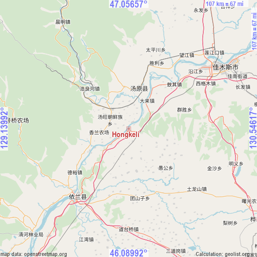
Hongkeli GPS coordinates[2]
46° 34' 31.44" North, 129° 50' 34.944" East
| Map corner | latitude | longitude |
|---|---|---|
| Upper-left | 47.05657°, | 129.13992° |
| Center: | 46.5754°, | 129.84304° |
| Lower-right: | 46.08992°, | 130.54617° |
| Map W x H: | 107.5×107.5 km | = 66.8×66.8mi |
| max Lat: | 53.31946° ⇑4% North |
| Hongkeli: | 46.5754° |
| min Lat: | ⇓96% South 18.22056° |
| min Long | Hongkeli | max Long |
| 75.07348° | 129.84304° | 134.28917° |
| W 99%⇐ | ⇒1% E |
Elevation
Elevation of Hongkeli is 92 m = 302 ft, and this is 392.8 m = 1289 ft below average elevation for this country.
| Max E: |
5622 m = 18445 ft | 61.1% |
| Avg. | 484.8 m = 1591 ft | |
| Hongkeli | 92 m = 302 ft | |
Min E: |
-3 m = -10 ft | 38.9% |
See also: China elevation on elevation.city.
Geographical zone
Hongkeli is located in North temperate zone (between Tropic of Cancer and the Arctic Circle). Distance of this North polar circle is 2222.5 km =1381 mi to North.| Distance of | km | miles | from Hongkeli |
|---|---|---|---|
| North Pole | 4828.4 | 3000.2 | to North |
| Arctic Circle | 2222.5 | 1381 | to North |
| Tropic Cancer | 2572.8 | 1598.7 | to South |
| Equator | 5178.7 | 3217.9 | to South |


Nearby cities:
15 places around Hongkeli: (largest is in red/bold)
• Aoqi
26.7 km =16.6 mi,  45°
45°
• Dalai
14.2 km =8.8 mi,  33°
33°
• Haolianghe
23.4 km =14.5 mi,  316°
316°
• Qingfa
33.8 km =21 mi,  142°
142°
• Qunsheng
24.9 km =15.5 mi,  70°
70°
• Shengli
29.9 km =18.6 mi,  23°
23°
• Taipingchuan
34.9 km =21.7 mi, 19°
• Tangwang
8.5 km =5.3 mi,  295°
295°
• Tangyuan
17.3 km =10.7 mi,  14°
14°
• Tuanshanzi
29.3 km =18.2 mi,  170°
170°
• Xianglan
10.9 km =6.8 mi, 319°
• Yilan
36.3 km =22.6 mi,  217°
217°
• Yinglan
34.7 km =21.6 mi, 221°
• Yugong
22.5 km =14 mi, 136°
• Zhulian
3.3 km =2.1 mi, 30°
Sources, notices
• [Note1] Compared only with cities in China existing in our database
• [Src1] Map data: © OpenStreetMap contributors (CC-BY-SA)
• [Src2] Other city data from geonames.org with taken over terms of usage.
• [Src3] Geographical zone / Annual Mean Temperature by Robert A. Rohde @ Wikipedia
