Handaqi geodata
Handaqi (Heilongjiang) is a seat of a fourth-order administrative division; located in China in Asia/Shanghai (GMT+8) time zone. In our database, there are 1268 cities with bigger population. Compared to other cities in China, 99.6% of cities are located further ↓South; 95.7% of cities are located further ←West and 71.8% of cities have lower elevation than Handaqi. Note1


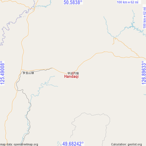
Handaqi GPS coordinates[2]
50° 8' 6.828" North, 126° 11' 35.52" East
| Map corner | latitude | longitude |
|---|---|---|
| Upper-left | 50.5838°, | 125.49008° |
| Center: | 50.13523°, | 126.1932° |
| Lower-right: | 49.68242°, | 126.89633° |
| Map W x H: | 100.2×100.2 km | = 62.3×62.3mi |
| max Lat: | 53.31946° ⇑0.4% North |
| Handaqi: | 50.13523° |
| min Lat: | ⇓99.6% South 18.22056° |
| min Long | Handaqi | max Long |
| 75.07348° | 126.1932° | 134.28917° |
| W 95.7%⇐ | ⇒4.3% E |
Elevation
Elevation of Handaqi is 448 m = 1470 ft, and this is 36.8 m = 121 ft below average elevation for this country.
| Max E: |
5622 m = 18445 ft | 28.2% |
| Avg. | 484.8 m = 1591 ft | |
| Handaqi | 448 m = 1470 ft | |
Min E: |
-3 m = -10 ft | 71.8% |
See also: China elevation on elevation.city.
Geographical zone
Handaqi is located in North temperate zone (between Tropic of Cancer and the Arctic Circle). Distance of this North polar circle is 1826.7 km =1135.1 mi to North.| Distance of | km | miles | from Handaqi |
|---|---|---|---|
| North Pole | 4432.5 | 2754.2 | to North |
| Arctic Circle | 1826.7 | 1135.1 | to North |
| Tropic Cancer | 2968.6 | 1844.6 | to South |
| Equator | 5574.5 | 3463.8 | to South |


Nearby cities:
15 places around Handaqi: (largest is in red/bold)
• Aihui
93.6 km =58.2 mi,  100°
100°
• Duobaoshan
29.7 km =18.5 mi,  269°
269°
• Erzhan
74.9 km =46.5 mi,  133°
133°
• Guli
91.7 km =57 mi, 265°
• Heihe
93.1 km =57.8 mi,  82°
82°
• Huolongmen
47.5 km =29.5 mi,  218°
218°
• Shangmachang
84.8 km =52.7 mi,  71°
71°
• Sijiazi
94.1 km =58.5 mi,  87°
87°
• Woniuhe
93.9 km =58.3 mi, 134°
• Xifengshan
72.7 km =45.2 mi,  48°
48°
• Xigangzi
86 km =53.4 mi,  107°
107°
• Xinfu
93 km =57.8 mi, 82°
• Xing’an
93.4 km =58 mi, 82°
• Xinsheng Elunchunzu
59.5 km =37 mi, 45°
• Zhangdiyingzi
92.7 km =57.6 mi,  60°
60°
Sources, notices
• [Note1] Compared only with cities in China existing in our database
• [Src1] Map data: © OpenStreetMap contributors (CC-BY-SA)
• [Src2] Other city data from geonames.org with taken over terms of usage.
• [Src3] Geographical zone / Annual Mean Temperature by Robert A. Rohde @ Wikipedia
