Shangmachang geodata
Shangmachang (Heilongjiang) is a seat of a fourth-order administrative division; located in China in Asia/Yakutsk (GMT+9) time zone. In our database, there are 1268 cities with bigger population. Compared to other cities in China, 99.6% of cities are located further ↓South; 97.3% of cities are located further ←West and 54.4% of cities have higher elevation than Shangmachang. Note1


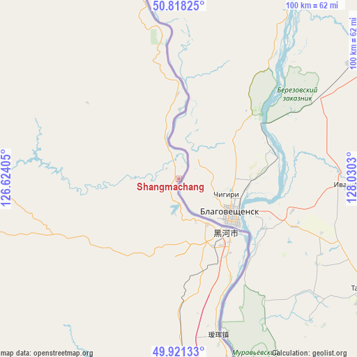
Shangmachang GPS coordinates[2]
50° 22' 18.876" North, 127° 19' 37.812" East
| Map corner | latitude | longitude |
|---|---|---|
| Upper-left | 50.81825°, | 126.62405° |
| Center: | 50.37191°, | 127.32717° |
| Lower-right: | 49.92133°, | 128.0303° |
| Map W x H: | 99.7×99.7 km | = 62×62mi |
| max Lat: | 53.31946° ⇑0.4% North |
| Shangmachang: | 50.37191° |
| min Lat: | ⇓99.6% South 18.22056° |
| min Long | Shangmachang | max Long |
| 75.07348° | 127.32717° | 134.28917° |
| W 97.3%⇐ | ⇒2.7% E |
Elevation
Elevation of Shangmachang is 135 m = 443 ft, and this is 349.8 m = 1148 ft below average elevation for this country.
| Max E: |
5622 m = 18445 ft | 54.4% |
| Avg. | 484.8 m = 1591 ft | |
| Shangmachang | 135 m = 443 ft | |
Min E: |
-3 m = -10 ft | 45.6% |
See also: China elevation on elevation.city.
Geographical zone
Shangmachang is located in North temperate zone (between Tropic of Cancer and the Arctic Circle). Distance of this North polar circle is 1800.3 km =1118.7 mi to North.| Distance of | km | miles | from Shangmachang |
|---|---|---|---|
| North Pole | 4406.2 | 2737.9 | to North |
| Arctic Circle | 1800.3 | 1118.7 | to North |
| Tropic Cancer | 2994.9 | 1860.9 | to South |
| Equator | 5600.8 | 3480.2 | to South |


Nearby cities:
15 places around Shangmachang: (largest is in red/bold)
• Aihui
45 km =28 mi,  165°
165°
• Erzhan
82.1 km =51 mi,  198°
198°
• Handaqi
84.8 km =52.7 mi,  251°
251°
• Heihe
18.3 km =11.4 mi,  140°
140°
• Kunheda Woerzu Manzu
55.6 km =34.5 mi, 166°
• Sanka
91.6 km =56.9 mi,  340°
340°
• Sijiazi
25.3 km =15.7 mi,  148°
148°
• Woniuhe
92.8 km =57.7 mi,  188°
188°
• Xifengshan
33.4 km =20.8 mi,  309°
309°
• Xigangzi
52.9 km =32.9 mi,  179°
179°
• Xinfu
18.9 km =11.7 mi, 142°
• Xing’an
18.2 km =11.3 mi, 139°
• Xinsheng Elunchunzu
40.9 km =25.4 mi,  292°
292°
• Yanjiang
94.6 km =58.8 mi,  159°
159°
• Zhangdiyingzi
19.5 km =12.1 mi,  0°
0°
Sources, notices
• [Note1] Compared only with cities in China existing in our database
• [Src1] Map data: © OpenStreetMap contributors (CC-BY-SA)
• [Src2] Other city data from geonames.org with taken over terms of usage.
• [Src3] Geographical zone / Annual Mean Temperature by Robert A. Rohde @ Wikipedia
