Erdaobaihe geodata
Erdaobaihe (Jilin) is a seat of a fourth-order administrative division; located in China in Asia/Shanghai (GMT+8) time zone. In our database, there are 1268 cities with bigger population. Compared to other cities in China, 91.3% of cities are located further ↓South; 98% of cities are located further ←West and 80.3% of cities have lower elevation than Erdaobaihe. Note1


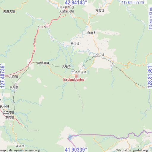
Erdaobaihe GPS coordinates[2]
42° 25' 28.416" North, 128° 6' 37.728" East
| Map corner | latitude | longitude |
|---|---|---|
| Upper-left | 42.94143°, | 127.40736° |
| Center: | 42.42456°, | 128.11048° |
| Lower-right: | 41.90339°, | 128.81361° |
| Map W x H: | 115.4×115.4 km | = 71.7×71.7mi |
| max Lat: | 53.31946° ⇑8.7% North |
| Erdaobaihe: | 42.42456° |
| min Lat: | ⇓91.3% South 18.22056° |
| min Long | Erdaobaihe | max Long |
| 75.07348° | 128.11048° | 134.28917° |
| W 98%⇐ | ⇒2% E |
Elevation
Elevation of Erdaobaihe is 708 m = 2323 ft, and this is 223.2 m = 732 ft above average elevation for this country.
| Max E: |
5622 m = 18445 ft | 19.7% |
| Erdaobaihe | 708 m 2323 ft | |
| Avg. | 484.8 m = 1591 ft | |
Min E: |
-3 m = -10 ft | 80.3% |
See also: China elevation on elevation.city.
Geographical zone
Erdaobaihe is located in North temperate zone (between Tropic of Cancer and the Arctic Circle). Distance of this Northern Tropic circle is 2111.2 km =1311.8 mi to South.| Distance of | km | miles | from Erdaobaihe |
|---|---|---|---|
| North Pole | 5289.9 | 3287 | to North |
| Arctic Circle | 2684 | 1667.8 | to North |
| Tropic Cancer | 2111.2 | 1311.8 | to South |
| Equator | 4717.2 | 2931.1 | to South |


Nearby cities:
15 places around Erdaobaihe: (largest is in red/bold)
• Baishuitan
45.1 km =28 mi,  325°
325°
• Beigang
47.3 km =29.4 mi,  269°
269°
• Dadianzi
52.8 km =32.8 mi,  19°
19°
• Dapuchaihe
51 km =31.7 mi,  352°
352°
• Dashahe
35.2 km =21.9 mi, 19°
• Donggang
59.1 km =36.7 mi,  240°
240°
• Dongjiang
25 km =15.5 mi,  358°
358°
• Lushuihe
28.9 km =18 mi,  291°
291°
• Quanyang
47.1 km =29.3 mi,  260°
260°
• Sandao
30.1 km =18.7 mi,  67°
67°
• Songjiang
25 km =15.5 mi,  47°
47°
• Songjiang
65.8 km =40.9 mi,  250°
250°
• Songjianghe
58.3 km =36.2 mi, 242°
• Xiaoshahe
28.2 km =17.5 mi,  32°
32°
• Xinglong
62.2 km =38.6 mi, 253°
Sources, notices
• [Note1] Compared only with cities in China existing in our database
• [Src1] Map data: © OpenStreetMap contributors (CC-BY-SA)
• [Src2] Other city data from geonames.org with taken over terms of usage.
• [Src3] Geographical zone / Annual Mean Temperature by Robert A. Rohde @ Wikipedia
