Dongping geodata
Dongping (Jilin) is a seat of a fourth-order administrative division; located in China in Asia/Shanghai (GMT+8) time zone. In our database, there are 1268 cities with bigger population. Compared to other cities in China, 95.1% of cities are located further ↓South; 93% of cities are located further ←West and 53.7% of cities have higher elevation than Dongping. Note1


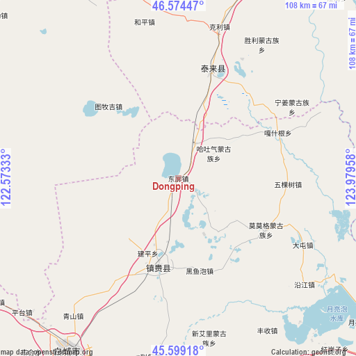
Dongping GPS coordinates[2]
46° 5' 20.328" North, 123° 16' 35.22" East
| Map corner | latitude | longitude |
|---|---|---|
| Upper-left | 46.57447°, | 122.57333° |
| Center: | 46.08898°, | 123.27645° |
| Lower-right: | 45.59918°, | 123.97958° |
| Map W x H: | 108.4×108.4 km | = 67.4×67.4mi |
| max Lat: | 53.31946° ⇑4.9% North |
| Dongping: | 46.08898° |
| min Lat: | ⇓95.1% South 18.22056° |
| min Long | Dongping | max Long |
| 75.07348° | 123.27645° | 134.28917° |
| W 93%⇐ | ⇒7% E |
Elevation
Elevation of Dongping is 139 m = 456 ft, and this is 345.8 m = 1135 ft below average elevation for this country.
| Max E: |
5622 m = 18445 ft | 53.7% |
| Avg. | 484.8 m = 1591 ft | |
| Dongping | 139 m = 456 ft | |
Min E: |
-3 m = -10 ft | 46.3% |
See also: China elevation on elevation.city.
Geographical zone
Dongping is located in North temperate zone (between Tropic of Cancer and the Arctic Circle). Distance of this North polar circle is 2276.6 km =1414.6 mi to North.| Distance of | km | miles | from Dongping |
|---|---|---|---|
| North Pole | 4882.4 | 3033.8 | to North |
| Arctic Circle | 2276.6 | 1414.6 | to North |
| Tropic Cancer | 2518.7 | 1565 | to South |
| Equator | 5124.6 | 3184.3 | to South |


Nearby cities:
15 places around Dongping: (largest is in red/bold)
• Baomin
16.2 km =10.1 mi,  0°
0°
• Dandai
48 km =29.8 mi,  64°
64°
• Ganq Ger
33.1 km =20.6 mi,  65°
65°
• Haoxin
33.4 km =20.8 mi,  40°
40°
• Heping
48.8 km =30.3 mi,  348°
348°
• Hongsheng
27.2 km =16.9 mi,  5°
5°
• Keli
47.8 km =29.7 mi,  15°
15°
• Ningjiang
40.9 km =25.4 mi, 57°
• Qingshan
50.6 km =31.4 mi,  219°
219°
• Shengli
48.1 km =29.9 mi,  32°
32°
• Tailai
35 km =21.7 mi, 17°
• Tantu
11.8 km =7.3 mi, 25°
• Tumuji
30.8 km =19.1 mi,  311°
311°
• Wukeshu
33.5 km =20.8 mi,  92°
92°
• Zhenlai
26.7 km =16.6 mi,  176°
176°
Sources, notices
• [Note1] Compared only with cities in China existing in our database
• [Src1] Map data: © OpenStreetMap contributors (CC-BY-SA)
• [Src2] Other city data from geonames.org with taken over terms of usage.
• [Src3] Geographical zone / Annual Mean Temperature by Robert A. Rohde @ Wikipedia
