Oukenhe geodata
Oukenhe (Inner Mongolia) is a seat of a fourth-order administrative division; located in China in Asia/Shanghai (GMT+8) time zone. In our database, there are 1268 cities with bigger population. Compared to other cities in China, 99.5% of cities are located further ↓South; 94.5% of cities are located further ←West and 64.8% of cities have lower elevation than Oukenhe. Note1


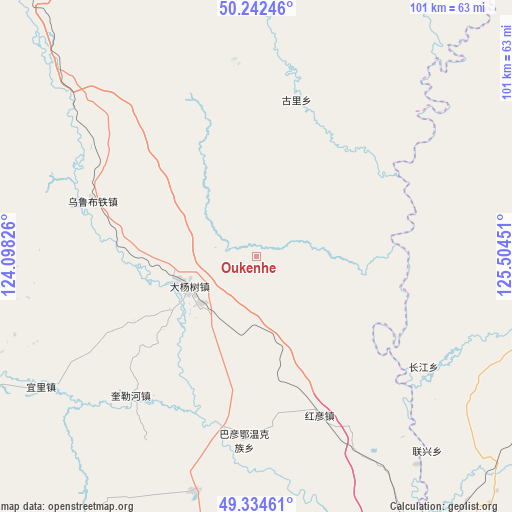
Oukenhe GPS coordinates[2]
49° 47' 26.376" North, 124° 48' 4.968" East
| Map corner | latitude | longitude |
|---|---|---|
| Upper-left | 50.24246°, | 124.09826° |
| Center: | 49.79066°, | 124.80138° |
| Lower-right: | 49.33461°, | 125.50451° |
| Map W x H: | 100.9×100.9 km | = 62.7×62.7mi |
| max Lat: | 53.31946° ⇑0.5% North |
| Oukenhe: | 49.79066° |
| min Lat: | ⇓99.5% South 18.22056° |
| min Long | Oukenhe | max Long |
| 75.07348° | 124.80138° | 134.28917° |
| W 94.5%⇐ | ⇒5.5% E |
Elevation
Elevation of Oukenhe is 322 m = 1056 ft, and this is 162.8 m = 534 ft below average elevation for this country.
| Max E: |
5622 m = 18445 ft | 35.2% |
| Avg. | 484.8 m = 1591 ft | |
| Oukenhe | 322 m = 1056 ft | |
Min E: |
-3 m = -10 ft | 64.8% |
See also: China elevation on elevation.city.
Geographical zone
Oukenhe is located in North temperate zone (between Tropic of Cancer and the Arctic Circle). Distance of this North polar circle is 1865 km =1158.9 mi to North.| Distance of | km | miles | from Oukenhe |
|---|---|---|---|
| North Pole | 4470.9 | 2778.1 | to North |
| Arctic Circle | 1865 | 1158.9 | to North |
| Tropic Cancer | 2930.3 | 1820.8 | to South |
| Equator | 5536.2 | 3440 | to South |


Nearby cities:
15 places around Oukenhe: (largest is in red/bold)
• Bayan Ewenke Minzu
36.6 km =22.7 mi,  183°
183°
• Dayangshu
17.5 km =10.9 mi,  254°
254°
• Duobaoshan
79.5 km =49.4 mi,  61°
61°
• E’erhe
68.1 km =42.3 mi,  162°
162°
• Guli
31.7 km =19.7 mi,  14°
14°
• Hadayang
62.4 km =38.8 mi,  151°
151°
• Hongyan
33.6 km =20.9 mi, 158°
• Huolongmen
70.1 km =43.6 mi,  89°
89°
• Kuilehe
36.9 km =22.9 mi,  222°
222°
• Kuleqi
22.5 km =14 mi,  232°
232°
• Linjiang
78.3 km =48.7 mi,  171°
171°
• Nenjiang
74.9 km =46.5 mi, 156°
• Woluohe
77 km =47.8 mi, 226°
• Wulu Butie
34.6 km =21.5 mi,  289°
289°
• Yili
49.7 km =30.9 mi,  238°
238°
Sources, notices
• [Note1] Compared only with cities in China existing in our database
• [Src1] Map data: © OpenStreetMap contributors (CC-BY-SA)
• [Src2] Other city data from geonames.org with taken over terms of usage.
• [Src3] Geographical zone / Annual Mean Temperature by Robert A. Rohde @ Wikipedia
