Xiangjiang geodata
Xiangjiang (Hunan) is a seat of a fourth-order administrative division; located in China in Asia/Shanghai (GMT+8) time zone. In our database, there are 1268 cities with bigger population. Compared to other cities in China, 86% of cities are located further ↑North; 63.5% of cities are located further →East and 81.7% of cities have lower elevation than Xiangjiang. Note1


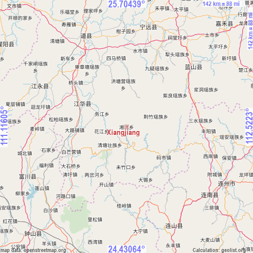
Xiangjiang GPS coordinates[2]
25° 4' 9.012" North, 111° 49' 9.012" East
| Map corner | latitude | longitude |
|---|---|---|
| Upper-left | 25.70439°, | 111.11605° |
| Center: | 25.06917°, | 111.81917° |
| Lower-right: | 24.43064°, | 112.5223° |
| Map W x H: | 141.6×141.6 km | = 88×88mi |
| max Lat: | 53.31946° ⇑86% North |
| Xiangjiang: | 25.06917° |
| min Lat: | ⇓14% South 18.22056° |
| min Long | Xiangjiang | max Long |
| 75.07348° | 111.81917° | 134.28917° |
| W 36.5%⇐ | ⇒63.5% E |
Elevation
Elevation of Xiangjiang is 774 m = 2539 ft, and this is 289.2 m = 949 ft above average elevation for this country.
| Max E: |
5622 m = 18445 ft | 18.3% |
| Xiangjiang | 774 m 2539 ft | |
| Avg. | 484.8 m = 1591 ft | |
Min E: |
-3 m = -10 ft | 81.7% |
See also: China elevation on elevation.city.
Geographical zone
Xiangjiang is located in North temperate zone (between Tropic of Cancer and the Arctic Circle). Distance of this Northern Tropic circle is 181.5 km =112.8 mi to South.| Distance of | km | miles | from Xiangjiang |
|---|---|---|---|
| North Pole | 7219.6 | 4486.1 | to North |
| Arctic Circle | 4613.7 | 2866.8 | to North |
| Tropic Cancer | 181.5 | 112.8 | to South |
| Equator | 2787.4 | 1732 | to South |


Nearby cities:
15 places around Xiangjiang: (largest is in red/bold)
• Daqiao
29.6 km =18.4 mi,  80°
80°
• Dongtian
19.3 km =12 mi,  297°
297°
• Hedong
43 km =26.7 mi,  142°
142°
• Hengling
31.1 km =19.3 mi,  343°
343°
• Huiyuan
44.1 km =27.4 mi,  38°
38°
• Jingzhu
17.4 km =10.8 mi,  70°
70°
• Jiuyi
37 km =23 mi,  27°
27°
• Qiaotou
37.7 km =23.4 mi,  311°
311°
• Sanshui
41.7 km =25.9 mi, 84°
• Shenzhangtang
38.7 km =24 mi,  325°
325°
• Simaqiao
39 km =24.2 mi,  351°
351°
• Songbo
36.9 km =22.9 mi,  276°
276°
• Suocheng
39.4 km =24.5 mi,  55°
55°
• Tuojiang
28.1 km =17.5 mi, 297°
• Ziliang
32.5 km =20.2 mi, 56°
Sources, notices
• [Note1] Compared only with cities in China existing in our database
• [Src1] Map data: © OpenStreetMap contributors (CC-BY-SA)
• [Src2] Other city data from geonames.org with taken over terms of usage.
• [Src3] Geographical zone / Annual Mean Temperature by Robert A. Rohde @ Wikipedia
