Liangjiazi geodata
Liangjiazi (Liaoning) is a seat of a fourth-order administrative division; located in China in Asia/Shanghai (GMT+8) time zone. In our database, there are 1268 cities with bigger population. Compared to other cities in China, 91.7% of cities are located further ↓South; 93.2% of cities are located further ←West and 62.3% of cities have higher elevation than Liangjiazi. Note1


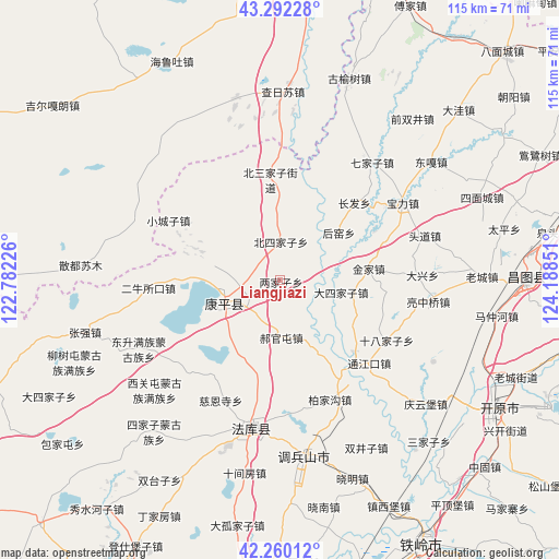
Liangjiazi GPS coordinates[2]
42° 46' 42.06" North, 123° 29' 7.368" East
| Map corner | latitude | longitude |
|---|---|---|
| Upper-left | 43.29228°, | 122.78226° |
| Center: | 42.77835°, | 123.48538° |
| Lower-right: | 42.26012°, | 124.18851° |
| Map W x H: | 114.8×114.8 km | = 71.3×71.3mi |
| max Lat: | 53.31946° ⇑8.3% North |
| Liangjiazi: | 42.77835° |
| min Lat: | ⇓91.7% South 18.22056° |
| min Long | Liangjiazi | max Long |
| 75.07348° | 123.48538° | 134.28917° |
| W 93.2%⇐ | ⇒6.8% E |
Elevation
Elevation of Liangjiazi is 86 m = 282 ft, and this is 398.8 m = 1308 ft below average elevation for this country.
| Max E: |
5622 m = 18445 ft | 62.3% |
| Avg. | 484.8 m = 1591 ft | |
| Liangjiazi | 86 m = 282 ft | |
Min E: |
-3 m = -10 ft | 37.7% |
See also: China elevation on elevation.city.
Geographical zone
Liangjiazi is located in North temperate zone (between Tropic of Cancer and the Arctic Circle). Distance of this Northern Tropic circle is 2150.6 km =1336.3 mi to South.| Distance of | km | miles | from Liangjiazi |
|---|---|---|---|
| North Pole | 5250.6 | 3262.6 | to North |
| Arctic Circle | 2644.7 | 1643.3 | to North |
| Tropic Cancer | 2150.6 | 1336.3 | to South |
| Equator | 4756.5 | 2955.6 | to South |


Nearby cities:
15 places around Liangjiazi: (largest is in red/bold)
• Beisijiazi
7.8 km =4.8 mi,  0°
0°
• Dasijiazi
12.6 km =7.8 mi,  101°
101°
• Daxing
29.3 km =18.2 mi,  87°
87°
• Dongguantun
14.7 km =9.1 mi,  229°
229°
• Dongsheng
32.2 km =20 mi,  244°
244°
• Erniusuokou
27 km =16.8 mi,  267°
267°
• Guyushu
24.5 km =15.2 mi,  133°
133°
• Haizhouwobao
20.1 km =12.5 mi,  332°
332°
• Haoguantun
11.6 km =7.2 mi,  179°
179°
• Jinjia
18.1 km =11.2 mi,  82°
82°
• Kangping
11.9 km =7.4 mi,  248°
248°
• Laowobao
17.4 km =10.8 mi,  12°
12°
• Shibajiazi
25.2 km =15.7 mi,  118°
118°
• Xiaochengzi
26 km =16.2 mi,  298°
298°
• Yongfeng
30 km =18.6 mi, 98°
Sources, notices
• [Note1] Compared only with cities in China existing in our database
• [Src1] Map data: © OpenStreetMap contributors (CC-BY-SA)
• [Src2] Other city data from geonames.org with taken over terms of usage.
• [Src3] Geographical zone / Annual Mean Temperature by Robert A. Rohde @ Wikipedia
