Yongfeng geodata
Yongfeng (Liaoning) is a seat of a fourth-order administrative division; located in China in Asia/Shanghai (GMT+8) time zone. In our database, there are 1268 cities with bigger population. Compared to other cities in China, 91.6% of cities are located further ↓South; 93.6% of cities are located further ←West and 59.7% of cities have higher elevation than Yongfeng. Note1


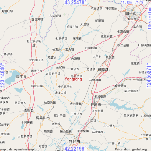
Yongfeng GPS coordinates[2]
42° 44' 25.908" North, 123° 50' 58.488" East
| Map corner | latitude | longitude |
|---|---|---|
| Upper-left | 43.25478°, | 123.14646° |
| Center: | 42.74053°, | 123.84958° |
| Lower-right: | 42.22198°, | 124.55271° |
| Map W x H: | 114.8×114.8 km | = 71.3×71.3mi |
| max Lat: | 53.31946° ⇑8.4% North |
| Yongfeng: | 42.74053° |
| min Lat: | ⇓91.6% South 18.22056° |
| min Long | Yongfeng | max Long |
| 75.07348° | 123.84958° | 134.28917° |
| W 93.6%⇐ | ⇒6.4% E |
Elevation
Elevation of Yongfeng is 100 m = 328 ft, and this is 384.8 m = 1262 ft below average elevation for this country.
| Max E: |
5622 m = 18445 ft | 59.7% |
| Avg. | 484.8 m = 1591 ft | |
| Yongfeng | 100 m = 328 ft | |
Min E: |
-3 m = -10 ft | 40.3% |
See also: China elevation on elevation.city.
Geographical zone
Yongfeng is located in North temperate zone (between Tropic of Cancer and the Arctic Circle). Distance of this Northern Tropic circle is 2146.4 km =1333.7 mi to South.| Distance of | km | miles | from Yongfeng |
|---|---|---|---|
| North Pole | 5254.8 | 3265.2 | to North |
| Arctic Circle | 2648.9 | 1645.9 | to North |
| Tropic Cancer | 2146.4 | 1333.7 | to South |
| Equator | 4752.3 | 2952.9 | to South |


Nearby cities:
15 places around Yongfeng: (largest is in red/bold)
• Beisijiazi
32 km =19.9 mi,  292°
292°
• Changtu
20.5 km =12.7 mi,  78°
78°
• Dasijiazi
17.4 km =10.8 mi,  275°
275°
• Daxing
5.3 km =3.3 mi,  355°
355°
• Ertaizi
22.1 km =13.7 mi,  48°
48°
• Guyushu
17.4 km =10.8 mi,  223°
223°
• Haoguantun
30.5 km =19 mi,  256°
256°
• Jinjia
13.6 km =8.5 mi,  299°
299°
• Kaiyuan
27.8 km =17.3 mi,  145°
145°
• Laocheng
12.7 km =7.9 mi,  67°
67°
• Laowobao
33.4 km =20.8 mi,  309°
309°
• Liangjiazi
30 km =18.6 mi, 278°
• Mazhonghe
14.5 km =9 mi,  101°
101°
• Quantou
29.6 km =18.4 mi,  62°
62°
• Shibajiazi
11.1 km =6.9 mi, 223°
Sources, notices
• [Note1] Compared only with cities in China existing in our database
• [Src1] Map data: © OpenStreetMap contributors (CC-BY-SA)
• [Src2] Other city data from geonames.org with taken over terms of usage.
• [Src3] Geographical zone / Annual Mean Temperature by Robert A. Rohde @ Wikipedia
