Dongsheng geodata
Dongsheng (Liaoning) is a seat of a fourth-order administrative division; located in China in Asia/Shanghai (GMT+8) time zone. In our database, there are 1268 cities with bigger population. Compared to other cities in China, 91.5% of cities are located further ↓South; 92.8% of cities are located further ←West and 59% of cities have higher elevation than Dongsheng. Note1


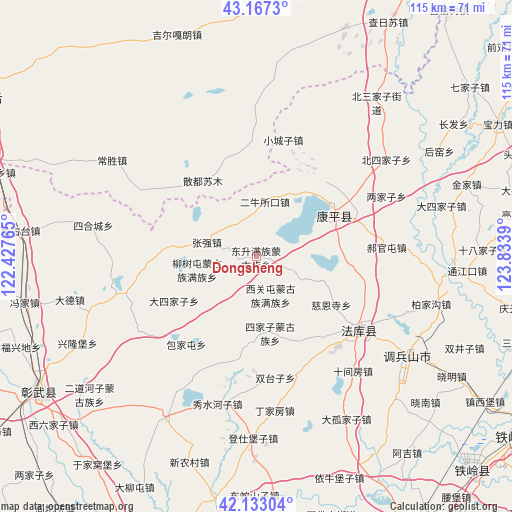
Dongsheng GPS coordinates[2]
42° 39' 8.352" North, 123° 7' 50.772" East
| Map corner | latitude | longitude |
|---|---|---|
| Upper-left | 43.1673°, | 122.42765° |
| Center: | 42.65232°, | 123.13077° |
| Lower-right: | 42.13304°, | 123.8339° |
| Map W x H: | 115×115 km | = 71.5×71.5mi |
| max Lat: | 53.31946° ⇑8.5% North |
| Dongsheng: | 42.65232° |
| min Lat: | ⇓91.5% South 18.22056° |
| min Long | Dongsheng | max Long |
| 75.07348° | 123.13077° | 134.28917° |
| W 92.8%⇐ | ⇒7.2% E |
Elevation
Elevation of Dongsheng is 104 m = 341 ft, and this is 380.8 m = 1249 ft below average elevation for this country.
| Max E: |
5622 m = 18445 ft | 59% |
| Avg. | 484.8 m = 1591 ft | |
| Dongsheng | 104 m = 341 ft | |
Min E: |
-3 m = -10 ft | 41% |
See also: China elevation on elevation.city.
Geographical zone
Dongsheng is located in North temperate zone (between Tropic of Cancer and the Arctic Circle). Distance of this Northern Tropic circle is 2136.6 km =1327.6 mi to South.| Distance of | km | miles | from Dongsheng |
|---|---|---|---|
| North Pole | 5264.6 | 3271.3 | to North |
| Arctic Circle | 2658.7 | 1652 | to North |
| Tropic Cancer | 2136.6 | 1327.6 | to South |
| Equator | 4742.5 | 2946.9 | to South |


Nearby cities:
15 places around Dongsheng: (largest is in red/bold)
• Beisijiazi
36.3 km =22.6 mi,  53°
53°
• Dasijiazi
42.9 km =26.7 mi,  74°
74°
• Dongguantun
18.4 km =11.4 mi,  75°
75°
• Erniusuokou
12.8 km =8 mi,  8°
8°
• Guyushu
46.9 km =29.1 mi,  93°
93°
• Haizhouwobao
37.3 km =23.2 mi,  31°
31°
• Haoguantun
29.2 km =18.1 mi, 85°
• Kangping
20.3 km =12.6 mi,  61°
61°
• Laowobao
45.2 km =28.1 mi, 46°
• Liangjiazi
32.2 km =20 mi, 64°
• Liushutun
13.6 km =8.5 mi,  257°
257°
• Xiaochengzi
27.1 km =16.8 mi, 12°
• Xiguantun Muguzu Manzuxiang
9.1 km =5.7 mi,  161°
161°
• Xizhahaqi
20.2 km =12.6 mi,  277°
277°
• Zhangqiang
11.9 km =7.4 mi,  286°
286°
Sources, notices
• [Note1] Compared only with cities in China existing in our database
• [Src1] Map data: © OpenStreetMap contributors (CC-BY-SA)
• [Src2] Other city data from geonames.org with taken over terms of usage.
• [Src3] Geographical zone / Annual Mean Temperature by Robert A. Rohde @ Wikipedia
