Guanlu geodata
Guanlu (Sichuan) is a seat of a fourth-order administrative division; located in China in Asia/Shanghai (GMT+8) time zone. In our database, there are 1268 cities with bigger population. Compared to other cities in China, 63.2% of cities are located further ↓South; 83.8% of cities are located further →East and 77.6% of cities have lower elevation than Guanlu. Note1


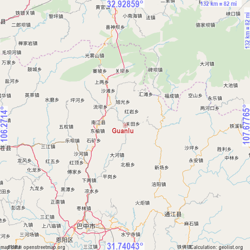
Guanlu GPS coordinates[2]
32° 20' 11.256" North, 106° 58' 28.272" East
| Map corner | latitude | longitude |
|---|---|---|
| Upper-left | 32.92859°, | 106.2714° |
| Center: | 32.33646°, | 106.97452° |
| Lower-right: | 31.74043°, | 107.67765° |
| Map W x H: | 132.1×132.1 km | = 82.1×82.1mi |
| max Lat: | 53.31946° ⇑36.8% North |
| Guanlu: | 32.33646° |
| min Lat: | ⇓63.2% South 18.22056° |
| min Long | Guanlu | max Long |
| 75.07348° | 106.97452° | 134.28917° |
| W 16.2%⇐ | ⇒83.8% E |
Elevation
Elevation of Guanlu is 598 m = 1962 ft, and this is 113.2 m = 371 ft above average elevation for this country.
| Max E: |
5622 m = 18445 ft | 22.4% |
| Guanlu | 598 m 1962 ft | |
| Avg. | 484.8 m = 1591 ft | |
Min E: |
-3 m = -10 ft | 77.6% |
See also: China elevation on elevation.city.
Geographical zone
Guanlu is located in North temperate zone (between Tropic of Cancer and the Arctic Circle). Distance of this Northern Tropic circle is 989.6 km =614.9 mi to South.| Distance of | km | miles | from Guanlu |
|---|---|---|---|
| North Pole | 6411.6 | 3984 | to North |
| Arctic Circle | 3805.7 | 2364.8 | to North |
| Tropic Cancer | 989.6 | 614.9 | to South |
| Equator | 3595.5 | 2234.1 | to South |


Nearby cities:
15 places around Guanlu: (largest is in red/bold)
• Chixi
28.3 km =17.6 mi,  224°
224°
• Dahe
16.1 km =10 mi,  194°
194°
• Dongyu
14.8 km =9.2 mi,  259°
259°
• Ganchang
8.9 km =5.5 mi,  328°
328°
• Guanba
29 km =18 mi,  357°
357°
• Leba
29 km =18 mi,  254°
254°
• Nanjiang
13.5 km =8.4 mi,  278°
278°
• Nianpan
12.5 km =7.8 mi,  285°
285°
• Pinggang
28.1 km =17.5 mi,  196°
196°
• Qiaoting
16 km =9.9 mi, 333°
• Shahe
27.7 km =17.2 mi,  237°
237°
• Shangliang
26.2 km =16.3 mi, 331°
• Tuanjie
22.6 km =14 mi, 256°
• Xingma
9.9 km =6.2 mi,  181°
181°
• Yangba
23.7 km =14.7 mi,  310°
310°
Sources, notices
• [Note1] Compared only with cities in China existing in our database
• [Src1] Map data: © OpenStreetMap contributors (CC-BY-SA)
• [Src2] Other city data from geonames.org with taken over terms of usage.
• [Src3] Geographical zone / Annual Mean Temperature by Robert A. Rohde @ Wikipedia
