Dongyang geodata
Dongyang (Shaanxi) is a seat of a fourth-order administrative division; located in China in Asia/Shanghai (GMT+8) time zone. In our database, there are 1268 cities with bigger population. Compared to other cities in China, 74.7% of cities are located further ↓South; 73.2% of cities are located further →East and 72.4% of cities have lower elevation than Dongyang. Note1


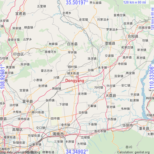
Dongyang GPS coordinates[2]
34° 55' 39.072" North, 109° 37' 47.748" East
| Map corner | latitude | longitude |
|---|---|---|
| Upper-left | 35.50197°, | 108.92681° |
| Center: | 34.92752°, | 109.62993° |
| Lower-right: | 34.34902°, | 110.33306° |
| Map W x H: | 128.2×128.2 km | = 79.7×79.7mi |
| max Lat: | 53.31946° ⇑25.3% North |
| Dongyang: | 34.92752° |
| min Lat: | ⇓74.7% South 18.22056° |
| min Long | Dongyang | max Long |
| 75.07348° | 109.62993° | 134.28917° |
| W 26.8%⇐ | ⇒73.2% E |
Elevation
Elevation of Dongyang is 462 m = 1516 ft, and this is 22.8 m = 75 ft below average elevation for this country.
| Max E: |
5622 m = 18445 ft | 27.6% |
| Avg. | 484.8 m = 1591 ft | |
| Dongyang | 462 m = 1516 ft | |
Min E: |
-3 m = -10 ft | 72.4% |
See also: China elevation on elevation.city.
Geographical zone
Dongyang is located in North temperate zone (between Tropic of Cancer and the Arctic Circle). Distance of this Northern Tropic circle is 1277.7 km =793.9 mi to South.| Distance of | km | miles | from Dongyang |
|---|---|---|---|
| North Pole | 6123.5 | 3805 | to North |
| Arctic Circle | 3517.6 | 2185.7 | to North |
| Tropic Cancer | 1277.7 | 793.9 | to South |
| Equator | 3883.6 | 2413.2 | to South |


Nearby cities:
15 places around Dongyang: (largest is in red/bold)
• Chenzhuang
6.6 km =4.1 mi,  201°
201°
• Chunlin
5.6 km =3.5 mi,  50°
50°
• Dangmu
12.6 km =7.8 mi,  183°
183°
• Dongchen
18.1 km =11.2 mi,  63°
63°
• Duanjia
18.2 km =11.3 mi,  109°
109°
• Jiaqu
8.1 km =5 mi,  262°
262°
• Longchi
14.1 km =8.8 mi,  162°
162°
• Longyang
10.5 km =6.5 mi,  150°
150°
• Pinglumiao
9.7 km =6 mi,  101°
101°
• Potou
17.5 km =10.9 mi,  286°
286°
• Pucheng Chengguanzhen
5.3 km =3.3 mi,  307°
307°
• Sanhe
11.5 km =7.1 mi, 294°
• Sunzhen
12.9 km =8 mi, 61°
• Xiangcunxiang
9.7 km =6 mi,  335°
335°
• Xingzhen
16.5 km =10.3 mi,  271°
271°
Sources, notices
• [Note1] Compared only with cities in China existing in our database
• [Src1] Map data: © OpenStreetMap contributors (CC-BY-SA)
• [Src2] Other city data from geonames.org with taken over terms of usage.
• [Src3] Geographical zone / Annual Mean Temperature by Robert A. Rohde @ Wikipedia
