Xingzhen geodata
Xingzhen (Shaanxi) is a seat of a fourth-order administrative division; located in China in Asia/Shanghai (GMT+8) time zone. In our database, there are 1268 cities with bigger population. Compared to other cities in China, 74.8% of cities are located further ↓South; 74.2% of cities are located further →East and 71.8% of cities have lower elevation than Xingzhen. Note1


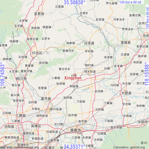
Xingzhen GPS coordinates[2]
34° 55' 55.812" North, 109° 26' 55.5" East
| Map corner | latitude | longitude |
|---|---|---|
| Upper-left | 35.50658°, | 108.74563° |
| Center: | 34.93217°, | 109.44875° |
| Lower-right: | 34.35371°, | 110.15188° |
| Map W x H: | 128.2×128.2 km | = 79.7×79.7mi |
| max Lat: | 53.31946° ⇑25.2% North |
| Xingzhen: | 34.93217° |
| min Lat: | ⇓74.8% South 18.22056° |
| min Long | Xingzhen | max Long |
| 75.07348° | 109.44875° | 134.28917° |
| W 25.8%⇐ | ⇒74.2% E |
Elevation
Elevation of Xingzhen is 448 m = 1470 ft, and this is 36.8 m = 121 ft below average elevation for this country.
| Max E: |
5622 m = 18445 ft | 28.2% |
| Avg. | 484.8 m = 1591 ft | |
| Xingzhen | 448 m = 1470 ft | |
Min E: |
-3 m = -10 ft | 71.8% |
See also: China elevation on elevation.city.
Geographical zone
Xingzhen is located in North temperate zone (between Tropic of Cancer and the Arctic Circle). Distance of this Northern Tropic circle is 1278.2 km =794.2 mi to South.| Distance of | km | miles | from Xingzhen |
|---|---|---|---|
| North Pole | 6123 | 3804.7 | to North |
| Arctic Circle | 3517.1 | 2185.4 | to North |
| Tropic Cancer | 1278.2 | 794.2 | to South |
| Equator | 3884.1 | 2413.5 | to South |


Nearby cities:
15 places around Xingzhen: (largest is in red/bold)
• Chenzhuang
15.6 km =9.7 mi,  115°
115°
• Daoxian
14.5 km =9 mi,  236°
236°
• Dongyang
16.5 km =10.3 mi,  91°
91°
• Jiaqu
8.6 km =5.3 mi,  100°
100°
• Jingyao
9.7 km =6 mi,  182°
182°
• Meiyuan
8.9 km =5.5 mi,  279°
279°
• Potou
4.3 km =2.7 mi,  356°
356°
• Pucheng Chengguanzhen
12.6 km =7.8 mi,  77°
77°
• Sanhe
7.4 km =4.6 mi,  54°
54°
• Shijia
14.1 km =8.8 mi,  205°
205°
• Sufang
8.1 km =5 mi, 240°
• Xiangcunxiang
15 km =9.3 mi,  56°
56°
• Xiaohui
16.4 km =10.2 mi,  261°
261°
• Xuezhen
14.1 km =8.8 mi, 280°
• Yuanren
15.1 km =9.4 mi, 177°
Sources, notices
• [Note1] Compared only with cities in China existing in our database
• [Src1] Map data: © OpenStreetMap contributors (CC-BY-SA)
• [Src2] Other city data from geonames.org with taken over terms of usage.
• [Src3] Geographical zone / Annual Mean Temperature by Robert A. Rohde @ Wikipedia
