Xinhuang geodata
Xinhuang (Jiangxi) is a seat of a fourth-order administrative division; located in China in Asia/Shanghai (GMT+8) time zone. In our database, there are 1268 cities with bigger population. Compared to other cities in China, 67.8% of cities are located further ↑North; 69.1% of cities are located further ←West and 59.2% of cities have higher elevation than Xinhuang. Note1


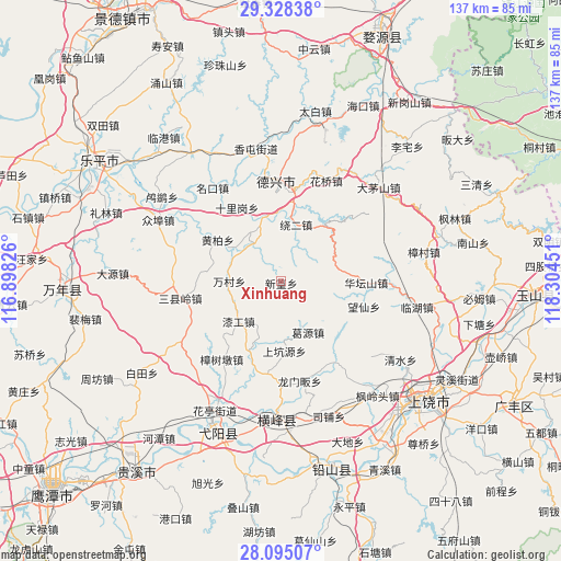
Xinhuang GPS coordinates[2]
28° 42' 48.744" North, 117° 36' 4.968" East
| Map corner | latitude | longitude |
|---|---|---|
| Upper-left | 29.32838°, | 116.89826° |
| Center: | 28.71354°, | 117.60138° |
| Lower-right: | 28.09507°, | 118.30451° |
| Map W x H: | 137.1×137.1 km | = 85.2×85.2mi |
| max Lat: | 53.31946° ⇑67.8% North |
| Xinhuang: | 28.71354° |
| min Lat: | ⇓32.2% South 18.22056° |
| min Long | Xinhuang | max Long |
| 75.07348° | 117.60138° | 134.28917° |
| W 69.1%⇐ | ⇒30.9% E |
Elevation
Elevation of Xinhuang is 103 m = 338 ft, and this is 381.8 m = 1253 ft below average elevation for this country.
| Max E: |
5622 m = 18445 ft | 59.2% |
| Avg. | 484.8 m = 1591 ft | |
| Xinhuang | 103 m = 338 ft | |
Min E: |
-3 m = -10 ft | 40.8% |
See also: China elevation on elevation.city.
Geographical zone
Xinhuang is located in North temperate zone (between Tropic of Cancer and the Arctic Circle). Distance of this Northern Tropic circle is 586.7 km =364.6 mi to South.| Distance of | km | miles | from Xinhuang |
|---|---|---|---|
| North Pole | 6814.4 | 4234.3 | to North |
| Arctic Circle | 4208.5 | 2615 | to North |
| Tropic Cancer | 586.7 | 364.6 | to South |
| Equator | 3192.6 | 1983.8 | to South |


Nearby cities:
15 places around Xinhuang: (largest is in red/bold)
• Caoxi
25.1 km =15.6 mi,  267°
267°
• Gangbian
28.8 km =17.9 mi,  162°
162°
• Geyuan
14.1 km =8.8 mi,  150°
150°
• Huatanshan
20.8 km =12.9 mi,  90°
90°
• Lieqiao
18.4 km =11.4 mi,  204°
204°
• Longmenfan
24.2 km =15 mi,  168°
168°
• Mingkou
28.2 km =17.5 mi,  323°
323°
• Puqian
26.7 km =16.6 mi,  177°
177°
• Qingban
22.9 km =14.2 mi,  187°
187°
• Qingban
22.9 km =14.2 mi, 196°
• Sanxianling
27.2 km =16.9 mi,  259°
259°
• Shiligang
20.5 km =12.7 mi,  329°
329°
• Wancun
12.6 km =7.8 mi, 269°
• Zhangcun
6.5 km =4 mi, 322°
• Zhengfang
28.1 km =17.5 mi, 92°
Sources, notices
• [Note1] Compared only with cities in China existing in our database
• [Src1] Map data: © OpenStreetMap contributors (CC-BY-SA)
• [Src2] Other city data from geonames.org with taken over terms of usage.
• [Src3] Geographical zone / Annual Mean Temperature by Robert A. Rohde @ Wikipedia
