Baitian geodata
Baitian (Jiangxi) is a seat of a fourth-order administrative division; located in China in Asia/Shanghai (GMT+8) time zone. In our database, there are 1268 cities with bigger population. Compared to other cities in China, 69.6% of cities are located further ↑North; 67.5% of cities are located further ←West and 65.2% of cities have higher elevation than Baitian. Note1


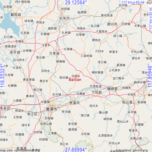
Baitian GPS coordinates[2]
28° 30' 34.56" North, 117° 15' 22.788" East
| Map corner | latitude | longitude |
|---|---|---|
| Upper-left | 29.12564°, | 116.55321° |
| Center: | 28.5096°, | 117.25633° |
| Lower-right: | 27.88994°, | 117.95946° |
| Map W x H: | 137.4×137.4 km | = 85.4×85.4mi |
| max Lat: | 53.31946° ⇑69.6% North |
| Baitian: | 28.5096° |
| min Lat: | ⇓30.4% South 18.22056° |
| min Long | Baitian | max Long |
| 75.07348° | 117.25633° | 134.28917° |
| W 67.5%⇐ | ⇒32.5% E |
Elevation
Elevation of Baitian is 72 m = 236 ft, and this is 412.8 m = 1354 ft below average elevation for this country.
| Max E: |
5622 m = 18445 ft | 65.2% |
| Avg. | 484.8 m = 1591 ft | |
| Baitian | 72 m = 236 ft | |
Min E: |
-3 m = -10 ft | 34.8% |
See also: China elevation on elevation.city.
Geographical zone
Baitian is located in North temperate zone (between Tropic of Cancer and the Arctic Circle). Distance of this Northern Tropic circle is 564.1 km =350.5 mi to South.| Distance of | km | miles | from Baitian |
|---|---|---|---|
| North Pole | 6837.1 | 4248.4 | to North |
| Arctic Circle | 4231.2 | 2629.1 | to North |
| Tropic Cancer | 564.1 | 350.5 | to South |
| Equator | 3170 | 1969.7 | to South |


Nearby cities:
15 places around Baitian: (largest is in red/bold)
• Caoxi
23.1 km =14.4 mi,  21°
21°
• Gexi
20.4 km =12.7 mi,  104°
104°
• Guifeng
23.5 km =14.6 mi,  150°
150°
• Hetan
16.2 km =10.1 mi,  166°
166°
• Huaqiao
20.9 km =13 mi,  271°
271°
• Huating
20 km =12.4 mi,  114°
114°
• Nanyan
22.4 km =13.9 mi,  123°
123°
• Peimei
20.8 km =12.9 mi,  314°
314°
• Qinghu
20.5 km =12.7 mi, 152°
• Sanxianling
19.2 km =11.9 mi, 21°
• Sili
15 km =9.3 mi,  215°
215°
• Wanli
13 km =8.1 mi, 118°
• Yiyang
20.7 km =12.9 mi, 124°
• Zhongfan
12.4 km =7.7 mi,  73°
73°
• Zhoufang
9 km =5.6 mi,  284°
284°
Sources, notices
• [Note1] Compared only with cities in China existing in our database
• [Src1] Map data: © OpenStreetMap contributors (CC-BY-SA)
• [Src2] Other city data from geonames.org with taken over terms of usage.
• [Src3] Geographical zone / Annual Mean Temperature by Robert A. Rohde @ Wikipedia
