Nanhe geodata
Nanhe (Gansu) is a seat of a fourth-order administrative division; located in China in Asia/Shanghai (GMT+8) time zone. In our database, there are 1268 cities with bigger population. Compared to other cities in China, 70.6% of cities are located further ↓South; 90% of cities are located further →East and 94.6% of cities have lower elevation than Nanhe. Note1


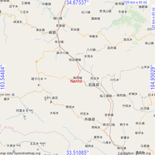
Nanhe GPS coordinates[2]
34° 5' 42.396" North, 104° 14' 49.776" East
| Map corner | latitude | longitude |
|---|---|---|
| Upper-left | 34.67537°, | 103.54404° |
| Center: | 34.09511°, | 104.24716° |
| Lower-right: | 33.51085°, | 104.95029° |
| Map W x H: | 129.5×129.5 km | = 80.5×80.5mi |
| max Lat: | 53.31946° ⇑29.4% North |
| Nanhe: | 34.09511° |
| min Lat: | ⇓70.6% South 18.22056° |
| min Long | Nanhe | max Long |
| 75.07348° | 104.24716° | 134.28917° |
| W 10%⇐ | ⇒90% E |
Elevation
Elevation of Nanhe is 1976 m = 6483 ft, and this is 1491.2 m = 4892 ft above average elevation for this country.
| Max E: |
5622 m = 18445 ft | 5.4% |
| Nanhe | 1976 m 6483 ft | |
| Avg. | 484.8 m = 1591 ft | |
Min E: |
-3 m = -10 ft | 94.6% |
See also: China elevation on elevation.city.
Geographical zone
Nanhe is located in North temperate zone (between Tropic of Cancer and the Arctic Circle). Distance of this Northern Tropic circle is 1185.1 km =736.4 mi to South.| Distance of | km | miles | from Nanhe |
|---|---|---|---|
| North Pole | 6216 | 3862.4 | to North |
| Arctic Circle | 3610.2 | 2243.3 | to North |
| Tropic Cancer | 1185.1 | 736.4 | to South |
| Equator | 3791 | 2355.6 | to South |


Nearby cities:
15 places around Nanhe: (largest is in red/bold)
• Bazang
29 km =18 mi,  221°
221°
• Chela
20 km =12.4 mi,  98°
98°
• Dangchang Chengguanzhen
14.7 km =9.1 mi,  112°
112°
• Guan’e
16.5 km =10.3 mi,  124°
124°
• Hadapu Zhen
15.3 km =9.5 mi,  351°
351°
• Hanban
25.4 km =15.8 mi,  193°
193°
• Hejiabao
9.1 km =5.7 mi,  135°
135°
• Jiahe
12.2 km =7.6 mi,  91°
91°
• Jiangtai
14.7 km =9.1 mi, 92°
• Lichuan Zhen
18.3 km =11.4 mi,  21°
21°
• Lijie
26.9 km =16.7 mi, 217°
• Linjiang
28.4 km =17.6 mi, 121°
• Luoda
27.4 km =17 mi,  243°
243°
• Quwa
30.5 km =19 mi,  230°
230°
• Xinchengzi
20 km =12.4 mi, 115°
Sources, notices
• [Note1] Compared only with cities in China existing in our database
• [Src1] Map data: © OpenStreetMap contributors (CC-BY-SA)
• [Src2] Other city data from geonames.org with taken over terms of usage.
• [Src3] Geographical zone / Annual Mean Temperature by Robert A. Rohde @ Wikipedia
