Hadapu Zhen geodata
Hadapu Zhen (Gansu) is a seat of a fourth-order administrative division; located in China in Asia/Shanghai (GMT+8) time zone. In our database, there are 1268 cities with bigger population. Compared to other cities in China, 71.2% of cities are located further ↓South; 90% of cities are located further →East and 95.3% of cities have lower elevation than Hadapu Zhen. Note1


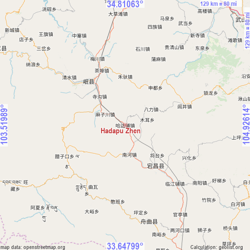
Hadapu Zhen GPS coordinates[2]
34° 13' 52.752" North, 104° 13' 22.836" East
| Map corner | latitude | longitude |
|---|---|---|
| Upper-left | 34.81063°, | 103.51989° |
| Center: | 34.23132°, | 104.22301° |
| Lower-right: | 33.64799°, | 104.92614° |
| Map W x H: | 129.3×129.3 km | = 80.3×80.3mi |
| max Lat: | 53.31946° ⇑28.8% North |
| Hadapu Zhen: | 34.23132° |
| min Lat: | ⇓71.2% South 18.22056° |
| min Long | Hadapu Zhen | max Long |
| 75.07348° | 104.22301° | 134.28917° |
| W 10%⇐ | ⇒90% E |
Elevation
Elevation of Hadapu Zhen is 2234 m = 7329 ft, and this is 1749.2 m = 5739 ft above average elevation for this country.
| Max E: |
5622 m = 18445 ft | 4.7% |
| Hadapu Zhen | 2234 m 7329 ft | |
| Avg. | 484.8 m = 1591 ft | |
Min E: |
-3 m = -10 ft | 95.3% |
See also: China elevation on elevation.city.
Geographical zone
Hadapu Zhen is located in North temperate zone (between Tropic of Cancer and the Arctic Circle). Distance of this Northern Tropic circle is 1200.2 km =745.8 mi to South.| Distance of | km | miles | from Hadapu Zhen |
|---|---|---|---|
| North Pole | 6200.9 | 3853.1 | to North |
| Arctic Circle | 3595 | 2233.8 | to North |
| Tropic Cancer | 1200.2 | 745.8 | to South |
| Equator | 3806.2 | 2365.1 | to South |


Nearby cities:
15 places around Hadapu Zhen: (largest is in red/bold)
• Chabu
30.8 km =19.1 mi,  337°
337°
• Chela
28.4 km =17.6 mi,  129°
129°
• Chengjiao Chengguanzhen
28.8 km =17.9 mi,  322°
322°
• Chengjiao Zhen
28.2 km =17.5 mi, 323°
• Dangchang Chengguanzhen
26.1 km =16.2 mi,  142°
142°
• Guan’e
29.1 km =18.1 mi,  147°
147°
• Hejiabao
23.3 km =14.5 mi,  158°
158°
• Jiahe
21.2 km =13.2 mi, 137°
• Jiangtai
23.1 km =14.4 mi, 133°
• Lichuan Zhen
9.1 km =5.7 mi,  77°
77°
• Lujing Zhen
32.2 km =20 mi,  72°
72°
• Nanhe
15.3 km =9.5 mi,  171°
171°
• Qinxu
25.9 km =16.1 mi,  305°
305°
• Sigou
19.9 km =12.4 mi, 318°
• Xinchengzi
31.3 km =19.4 mi, 139°
Sources, notices
• [Note1] Compared only with cities in China existing in our database
• [Src1] Map data: © OpenStreetMap contributors (CC-BY-SA)
• [Src2] Other city data from geonames.org with taken over terms of usage.
• [Src3] Geographical zone / Annual Mean Temperature by Robert A. Rohde @ Wikipedia
