Tunzhai geodata
Tunzhai (Gansu) is a seat of a fourth-order administrative division; located in China in Asia/Shanghai (GMT+8) time zone. In our database, there are 1268 cities with bigger population. Compared to other cities in China, 66.9% of cities are located further ↓South; 89.3% of cities are located further →East and 88.5% of cities have lower elevation than Tunzhai. Note1


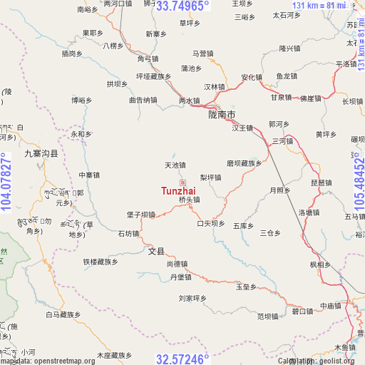
Tunzhai GPS coordinates[2]
33° 9' 46.908" North, 104° 46' 53.004" East
| Map corner | latitude | longitude |
|---|---|---|
| Upper-left | 33.74965°, | 104.07827° |
| Center: | 33.16303°, | 104.78139° |
| Lower-right: | 32.57246°, | 105.48452° |
| Map W x H: | 130.9×130.9 km | = 81.3×81.3mi |
| max Lat: | 53.31946° ⇑33.1% North |
| Tunzhai: | 33.16303° |
| min Lat: | ⇓66.9% South 18.22056° |
| min Long | Tunzhai | max Long |
| 75.07348° | 104.78139° | 134.28917° |
| W 10.7%⇐ | ⇒89.3% E |
Elevation
Elevation of Tunzhai is 1226 m = 4022 ft, and this is 741.2 m = 2432 ft above average elevation for this country.
| Max E: |
5622 m = 18445 ft | 11.5% |
| Tunzhai | 1226 m 4022 ft | |
| Avg. | 484.8 m = 1591 ft | |
Min E: |
-3 m = -10 ft | 88.5% |
See also: China elevation on elevation.city.
Geographical zone
Tunzhai is located in North temperate zone (between Tropic of Cancer and the Arctic Circle). Distance of this Northern Tropic circle is 1081.5 km =672 mi to South.| Distance of | km | miles | from Tunzhai |
|---|---|---|---|
| North Pole | 6319.7 | 3926.9 | to North |
| Arctic Circle | 3713.8 | 2307.6 | to North |
| Tropic Cancer | 1081.5 | 672 | to South |
| Equator | 3687.4 | 2291.2 | to South |


Nearby cities:
15 places around Tunzhai: (largest is in red/bold)
• Baoziba
16 km =9.9 mi,  234°
234°
• Dongjiang
28.7 km =17.8 mi,  33°
33°
• Jianshan
16.5 km =10.3 mi,  155°
155°
• Jinping
27 km =16.8 mi,  0°
0°
• Linjiang
17.2 km =10.7 mi,  130°
130°
• Liping
9.9 km =6.2 mi,  75°
75°
• Moba
23.2 km =14.4 mi,  71°
71°
• Qiaotou
6.8 km =4.2 mi, 155°
• Shangde
28.5 km =17.7 mi,  182°
182°
• Sheshu
15 km =9.3 mi, 73°
• Shifang
26.5 km =16.5 mi, 227°
• Tieba
26.9 km =16.7 mi,  325°
325°
• Waina
25.4 km =15.8 mi, 79°
• Wenxian Chengguanzhen
25.8 km =16 mi,  201°
201°
• Wuku
26.3 km =16.3 mi,  124°
124°
Sources, notices
• [Note1] Compared only with cities in China existing in our database
• [Src1] Map data: © OpenStreetMap contributors (CC-BY-SA)
• [Src2] Other city data from geonames.org with taken over terms of usage.
• [Src3] Geographical zone / Annual Mean Temperature by Robert A. Rohde @ Wikipedia
