Wuku geodata
Wuku (Gansu) is a seat of a fourth-order administrative division; located in China in Asia/Shanghai (GMT+8) time zone. In our database, there are 1268 cities with bigger population. Compared to other cities in China, 66.2% of cities are located further ↓South; 89.1% of cities are located further →East and 89.8% of cities have lower elevation than Wuku. Note1


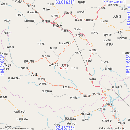
Wuku GPS coordinates[2]
33° 1' 43.644" North, 105° 0' 49.5" East
| Map corner | latitude | longitude |
|---|---|---|
| Upper-left | 33.61631°, | 104.31063° |
| Center: | 33.02879°, | 105.01375° |
| Lower-right: | 32.43733°, | 105.71688° |
| Map W x H: | 131.1×131.1 km | = 81.5×81.5mi |
| max Lat: | 53.31946° ⇑33.8% North |
| Wuku: | 33.02879° |
| min Lat: | ⇓66.2% South 18.22056° |
| min Long | Wuku | max Long |
| 75.07348° | 105.01375° | 134.28917° |
| W 10.9%⇐ | ⇒89.1% E |
Elevation
Elevation of Wuku is 1344 m = 4409 ft, and this is 859.2 m = 2819 ft above average elevation for this country.
| Max E: |
5622 m = 18445 ft | 10.2% |
| Wuku | 1344 m 4409 ft | |
| Avg. | 484.8 m = 1591 ft | |
Min E: |
-3 m = -10 ft | 89.8% |
See also: China elevation on elevation.city.
Geographical zone
Wuku is located in North temperate zone (between Tropic of Cancer and the Arctic Circle). Distance of this Northern Tropic circle is 1066.5 km =662.7 mi to South.| Distance of | km | miles | from Wuku |
|---|---|---|---|
| North Pole | 6334.6 | 3936.1 | to North |
| Arctic Circle | 3728.7 | 2316.9 | to North |
| Tropic Cancer | 1066.5 | 662.7 | to South |
| Equator | 3672.5 | 2282 | to South |


Nearby cities:
15 places around Wuku: (largest is in red/bold)
• Caohe
12.4 km =7.7 mi,  149°
149°
• Jianshan
14.8 km =9.2 mi,  269°
269°
• Koutouba
11.9 km =7.4 mi,  214°
214°
• Linjiang
9.4 km =5.8 mi,  293°
293°
• Liping
21.2 km =13.2 mi,  325°
325°
• Luotang
23.8 km =14.8 mi,  79°
79°
• Moba
22.2 km =13.8 mi,  1°
1°
• Pandi
15.9 km =9.9 mi,  95°
95°
• Qiaotou
20.8 km =12.9 mi, 294°
• Sancang
9.6 km =6 mi, 100°
• Sheshu
20.4 km =12.7 mi,  339°
339°
• Toufang
25.9 km =16.1 mi,  18°
18°
• Tunzhai
26.3 km =16.3 mi,  304°
304°
• Waina
20 km =12.4 mi,  9°
9°
• Yuezhao
18.5 km =11.5 mi,  47°
47°
Sources, notices
• [Note1] Compared only with cities in China existing in our database
• [Src1] Map data: © OpenStreetMap contributors (CC-BY-SA)
• [Src2] Other city data from geonames.org with taken over terms of usage.
• [Src3] Geographical zone / Annual Mean Temperature by Robert A. Rohde @ Wikipedia
