Muyi geodata
Muyi (Shaanxi) is a seat of a fourth-order administrative division; located in China in Asia/Shanghai (GMT+8) time zone. In our database, there are 1268 cities with bigger population. Compared to other cities in China, 72.1% of cities are located further ↓South; 82.4% of cities are located further →East and 80.5% of cities have lower elevation than Muyi. Note1


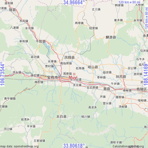
Muyi GPS coordinates[2]
34° 23' 18.312" North, 107° 26' 18.816" East
| Map corner | latitude | longitude |
|---|---|---|
| Upper-left | 34.96664°, | 106.73544° |
| Center: | 34.38842°, | 107.43856° |
| Lower-right: | 33.80618°, | 108.14169° |
| Map W x H: | 129×129 km | = 80.2×80.2mi |
| max Lat: | 53.31946° ⇑27.9% North |
| Muyi: | 34.38842° |
| min Lat: | ⇓72.1% South 18.22056° |
| min Long | Muyi | max Long |
| 75.07348° | 107.43856° | 134.28917° |
| W 17.6%⇐ | ⇒82.4% E |
Elevation
Elevation of Muyi is 718 m = 2356 ft, and this is 233.2 m = 765 ft above average elevation for this country.
| Max E: |
5622 m = 18445 ft | 19.5% |
| Muyi | 718 m 2356 ft | |
| Avg. | 484.8 m = 1591 ft | |
Min E: |
-3 m = -10 ft | 80.5% |
See also: China elevation on elevation.city.
Geographical zone
Muyi is located in North temperate zone (between Tropic of Cancer and the Arctic Circle). Distance of this Northern Tropic circle is 1217.7 km =756.6 mi to South.| Distance of | km | miles | from Muyi |
|---|---|---|---|
| North Pole | 6183.4 | 3842.2 | to North |
| Arctic Circle | 3577.5 | 2223 | to North |
| Tropic Cancer | 1217.7 | 756.6 | to South |
| Equator | 3823.6 | 2375.9 | to South |


Nearby cities:
15 places around Muyi: (largest is in red/bold)
• Bayu
15.9 km =9.9 mi,  248°
248°
• Biaojiao
7.5 km =4.7 mi,  46°
46°
• Diaowei
13 km =8.1 mi,  146°
146°
• Fengxiang Chengguanzhen
15.6 km =9.7 mi,  343°
343°
• Guodian
7.6 km =4.7 mi,  350°
350°
• Guowang
8 km =5 mi,  93°
93°
• Guozhen
7.7 km =4.8 mi, 251°
• Hengshui
11.9 km =7.4 mi,  41°
41°
• Nanzhihui
11.9 km =7.4 mi,  320°
320°
• Panxi
7.9 km =4.9 mi,  203°
203°
• Qianhe
12.5 km =7.8 mi,  272°
272°
• Tianjiazhuang
14.5 km =9 mi,  13°
13°
• Tianwang
10.1 km =6.3 mi,  163°
163°
• Yangping
7.3 km =4.5 mi,  140°
140°
• Zhouyuan
5.8 km =3.6 mi,  277°
277°
Sources, notices
• [Note1] Compared only with cities in China existing in our database
• [Src1] Map data: © OpenStreetMap contributors (CC-BY-SA)
• [Src2] Other city data from geonames.org with taken over terms of usage.
• [Src3] Geographical zone / Annual Mean Temperature by Robert A. Rohde @ Wikipedia
