Nanzhihui geodata
Nanzhihui (Shaanxi) is a seat of a fourth-order administrative division; located in China in Asia/Shanghai (GMT+8) time zone. In our database, there are 1268 cities with bigger population. Compared to other cities in China, 72.6% of cities are located further ↓South; 82.6% of cities are located further →East and 81.8% of cities have lower elevation than Nanzhihui. Note1


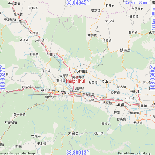
Nanzhihui GPS coordinates[2]
34° 28' 14.88" North, 107° 21' 21.204" East
| Map corner | latitude | longitude |
|---|---|---|
| Upper-left | 35.04845°, | 106.65277° |
| Center: | 34.4708°, | 107.35589° |
| Lower-right: | 33.88913°, | 108.05902° |
| Map W x H: | 128.9×128.9 km | = 80.1×80.1mi |
| max Lat: | 53.31946° ⇑27.4% North |
| Nanzhihui: | 34.4708° |
| min Lat: | ⇓72.6% South 18.22056° |
| min Long | Nanzhihui | max Long |
| 75.07348° | 107.35589° | 134.28917° |
| W 17.4%⇐ | ⇒82.6% E |
Elevation
Elevation of Nanzhihui is 778 m = 2552 ft, and this is 293.2 m = 962 ft above average elevation for this country.
| Max E: |
5622 m = 18445 ft | 18.2% |
| Nanzhihui | 778 m 2552 ft | |
| Avg. | 484.8 m = 1591 ft | |
Min E: |
-3 m = -10 ft | 81.8% |
See also: China elevation on elevation.city.
Geographical zone
Nanzhihui is located in North temperate zone (between Tropic of Cancer and the Arctic Circle). Distance of this Northern Tropic circle is 1226.9 km =762.4 mi to South.| Distance of | km | miles | from Nanzhihui |
|---|---|---|---|
| North Pole | 6174.3 | 3836.5 | to North |
| Arctic Circle | 3568.4 | 2217.3 | to North |
| Tropic Cancer | 1226.9 | 762.4 | to South |
| Equator | 3832.8 | 2381.6 | to South |


Nearby cities:
15 places around Nanzhihui: (largest is in red/bold)
• Biaojiao
13.5 km =8.4 mi,  107°
107°
• Dongjiahe
12.8 km =8 mi,  1°
1°
• Fanjiazhai
14.7 km =9.1 mi,  15°
15°
• Fengxiang Chengguanzhen
6.6 km =4.1 mi,  29°
29°
• Guodian
6.6 km =4.1 mi,  104°
104°
• Guozhen
11.7 km =7.3 mi,  178°
178°
• Hengshui
15.4 km =9.6 mi,  90°
90°
• Jiacun
14 km =8.7 mi,  261°
261°
• Liulin
9.7 km =6 mi,  334°
334°
• Meiganqiao
11.8 km =7.3 mi,  47°
47°
• Muyi
11.9 km =7.4 mi,  140°
140°
• Qianhe
9.9 km =6.2 mi,  209°
209°
• Tangcun
7.4 km =4.6 mi,  323°
323°
• Tianjiazhuang
12.1 km =7.5 mi,  65°
65°
• Zhouyuan
8.6 km =5.3 mi,  167°
167°
Sources, notices
• [Note1] Compared only with cities in China existing in our database
• [Src1] Map data: © OpenStreetMap contributors (CC-BY-SA)
• [Src2] Other city data from geonames.org with taken over terms of usage.
• [Src3] Geographical zone / Annual Mean Temperature by Robert A. Rohde @ Wikipedia
