Yuhuang geodata
Yuhuang (Gansu) is a seat of a fourth-order administrative division; located in China in Asia/Shanghai (GMT+8) time zone. In our database, there are 1268 cities with bigger population. Compared to other cities in China, 67.4% of cities are located further ↓South; 88.7% of cities are located further →East and 89.7% of cities have lower elevation than Yuhuang. Note1


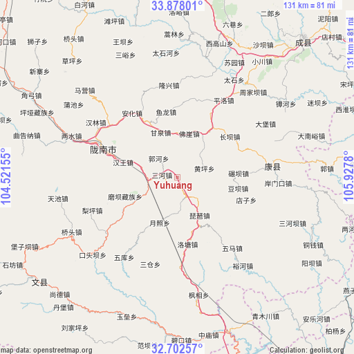
Yuhuang GPS coordinates[2]
33° 17' 32.172" North, 105° 13' 28.812" East
| Map corner | latitude | longitude |
|---|---|---|
| Upper-left | 33.87801°, | 104.52155° |
| Center: | 33.29227°, | 105.22467° |
| Lower-right: | 32.70257°, | 105.9278° |
| Map W x H: | 130.7×130.7 km | = 81.2×81.2mi |
| max Lat: | 53.31946° ⇑32.6% North |
| Yuhuang: | 33.29227° |
| min Lat: | ⇓67.4% South 18.22056° |
| min Long | Yuhuang | max Long |
| 75.07348° | 105.22467° | 134.28917° |
| W 11.3%⇐ | ⇒88.7% E |
Elevation
Elevation of Yuhuang is 1338 m = 4390 ft, and this is 853.2 m = 2799 ft above average elevation for this country.
| Max E: |
5622 m = 18445 ft | 10.3% |
| Yuhuang | 1338 m 4390 ft | |
| Avg. | 484.8 m = 1591 ft | |
Min E: |
-3 m = -10 ft | 89.7% |
See also: China elevation on elevation.city.
Geographical zone
Yuhuang is located in North temperate zone (between Tropic of Cancer and the Arctic Circle). Distance of this Northern Tropic circle is 1095.8 km =680.9 mi to South.| Distance of | km | miles | from Yuhuang |
|---|---|---|---|
| North Pole | 6305.3 | 3917.9 | to North |
| Arctic Circle | 3699.4 | 2298.7 | to North |
| Tropic Cancer | 1095.8 | 680.9 | to South |
| Equator | 3701.8 | 2300.2 | to South |


Nearby cities:
15 places around Yuhuang: (largest is in red/bold)
• Foya
16.8 km =10.4 mi,  15°
15°
• Ganquan
17.7 km =11 mi,  340°
340°
• Guohe
9.6 km =6 mi,  312°
312°
• Hanwang
20.7 km =12.9 mi,  285°
285°
• Huangping
10.5 km =6.5 mi,  71°
71°
• Jiegan
12 km =7.5 mi,  268°
268°
• Longfeng
20.2 km =12.6 mi,  304°
304°
• Moba
20.5 km =12.7 mi,  249°
249°
• Pipa
16.3 km =10.1 mi,  149°
149°
• Sanhe
5.4 km =3.4 mi,  278°
278°
• Toufang
12.5 km =7.8 mi, 247°
• Waina
18.9 km =11.7 mi,  239°
239°
• Wangguan
22.5 km =14 mi,  34°
34°
• Xiongchi
16 km =9.9 mi,  37°
37°
• Yuezhao
17.9 km =11.1 mi,  199°
199°
Sources, notices
• [Note1] Compared only with cities in China existing in our database
• [Src1] Map data: © OpenStreetMap contributors (CC-BY-SA)
• [Src2] Other city data from geonames.org with taken over terms of usage.
• [Src3] Geographical zone / Annual Mean Temperature by Robert A. Rohde @ Wikipedia
