Mayuan geodata
Mayuan (Gansu) is a seat of a fourth-order administrative division; located in China in Asia/Shanghai (GMT+8) time zone. In our database, there are 1268 cities with bigger population. Compared to other cities in China, 70.3% of cities are located further ↓South; 88.2% of cities are located further →East and 91.6% of cities have lower elevation than Mayuan. Note1


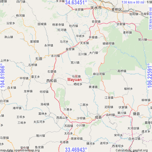
Mayuan GPS coordinates[2]
34° 3' 14.292" North, 105° 31' 22.008" East
| Map corner | latitude | longitude |
|---|---|---|
| Upper-left | 34.63451°, | 104.81966° |
| Center: | 34.05397°, | 105.52278° |
| Lower-right: | 33.46943°, | 106.22591° |
| Map W x H: | 129.5×129.5 km | = 80.5×80.5mi |
| max Lat: | 53.31946° ⇑29.7% North |
| Mayuan: | 34.05397° |
| min Lat: | ⇓70.3% South 18.22056° |
| min Long | Mayuan | max Long |
| 75.07348° | 105.52278° | 134.28917° |
| W 11.8%⇐ | ⇒88.2% E |
Elevation
Elevation of Mayuan is 1529 m = 5016 ft, and this is 1044.2 m = 3426 ft above average elevation for this country.
| Max E: |
5622 m = 18445 ft | 8.4% |
| Mayuan | 1529 m 5016 ft | |
| Avg. | 484.8 m = 1591 ft | |
Min E: |
-3 m = -10 ft | 91.6% |
See also: China elevation on elevation.city.
Geographical zone
Mayuan is located in North temperate zone (between Tropic of Cancer and the Arctic Circle). Distance of this Northern Tropic circle is 1180.5 km =733.5 mi to South.| Distance of | km | miles | from Mayuan |
|---|---|---|---|
| North Pole | 6220.6 | 3865.3 | to North |
| Arctic Circle | 3614.7 | 2246.1 | to North |
| Tropic Cancer | 1180.5 | 733.5 | to South |
| Equator | 3786.4 | 2352.8 | to South |


Nearby cities:
15 places around Mayuan: (largest is in red/bold)
• Erlang
24.6 km =15.3 mi,  165°
165°
• Hanyuan
21.8 km =13.5 mi,  257°
257°
• Heba
31.1 km =19.3 mi,  245°
245°
• Huangzhu
17.6 km =10.9 mi,  123°
123°
• Jiangxi
30.4 km =18.9 mi, 258°
• Liuxiang
29.2 km =18.1 mi,  194°
194°
• Luhe
17.5 km =10.9 mi, 253°
• Mayanhe
19.8 km =12.3 mi,  84°
84°
• Shaijing
8.5 km =5.3 mi,  201°
201°
• Shibao
21.1 km =13.1 mi,  281°
281°
• Shili
24.1 km =15 mi,  241°
241°
• Suhe
27.7 km =17.2 mi,  271°
271°
• Wangmo
26.7 km =16.6 mi,  147°
147°
• Xinglong
16.5 km =10.3 mi, 263°
• Zhaowu
21.1 km =13.1 mi, 248°
Sources, notices
• [Note1] Compared only with cities in China existing in our database
• [Src1] Map data: © OpenStreetMap contributors (CC-BY-SA)
• [Src2] Other city data from geonames.org with taken over terms of usage.
• [Src3] Geographical zone / Annual Mean Temperature by Robert A. Rohde @ Wikipedia
