Biashizang geodata
Biashizang (Gansu) is a seat of a fourth-order administrative division; located in China in Asia/Shanghai (GMT+8) time zone. In our database, there are 1268 cities with bigger population. Compared to other cities in China, 76.3% of cities are located further ↓South; 91.6% of cities are located further →East and 95.1% of cities have lower elevation than Biashizang. Note1


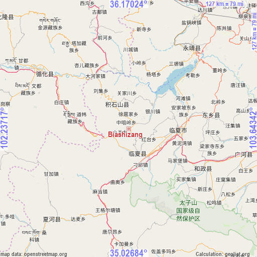
Biashizang GPS coordinates[2]
35° 36' 2.088" North, 102° 56' 25.044" East
| Map corner | latitude | longitude |
|---|---|---|
| Upper-left | 36.17024°, | 102.23717° |
| Center: | 35.60058°, | 102.94029° |
| Lower-right: | 35.02684°, | 103.64342° |
| Map W x H: | 127.1×127.1 km | = 79×79mi |
| max Lat: | 53.31946° ⇑23.7% North |
| Biashizang: | 35.60058° |
| min Lat: | ⇓76.3% South 18.22056° |
| min Long | Biashizang | max Long |
| 75.07348° | 102.94029° | 134.28917° |
| W 8.4%⇐ | ⇒91.6% E |
Elevation
Elevation of Biashizang is 2148 m = 7047 ft, and this is 1663.2 m = 5457 ft above average elevation for this country.
| Max E: |
5622 m = 18445 ft | 4.9% |
| Biashizang | 2148 m 7047 ft | |
| Avg. | 484.8 m = 1591 ft | |
Min E: |
-3 m = -10 ft | 95.1% |
See also: China elevation on elevation.city.
Geographical zone
Biashizang is located in North temperate zone (between Tropic of Cancer and the Arctic Circle). Distance of this Northern Tropic circle is 1352.5 km =840.4 mi to South.| Distance of | km | miles | from Biashizang |
|---|---|---|---|
| North Pole | 6048.6 | 3758.4 | to North |
| Arctic Circle | 3442.8 | 2139.3 | to North |
| Tropic Cancer | 1352.5 | 840.4 | to South |
| Equator | 3958.4 | 2459.6 | to South |


Nearby cities:
15 places around Biashizang: (largest is in red/bold)
• Chuimatan
14.4 km =8.9 mi,  335°
335°
• Guogan
7.4 km =4.6 mi,  39°
39°
• Hanji
12.6 km =7.8 mi,  157°
157°
• Hulinjia
13.9 km =8.6 mi,  359°
359°
• Juiji
5.6 km =3.5 mi,  351°
351°
• Liugou
17.8 km =11.1 mi,  333°
333°
• Maji
17.6 km =10.9 mi,  165°
165°
• Manisi
10.1 km =6.3 mi,  186°
186°
• Monigou
14.8 km =9.2 mi,  176°
176°
• Xiaoguan
4.7 km =2.9 mi,  247°
247°
• Xuhujia
7.2 km =4.5 mi,  8°
8°
• Yingtan
4.1 km =2.5 mi,  137°
137°
• Zhaizigou
9.8 km =6.1 mi, 332°
• Zhangzigou
8.9 km =5.5 mi, 162°
• Zhongzuiling
3.6 km =2.2 mi, 339°
Sources, notices
• [Note1] Compared only with cities in China existing in our database
• [Src1] Map data: © OpenStreetMap contributors (CC-BY-SA)
• [Src2] Other city data from geonames.org with taken over terms of usage.
• [Src3] Geographical zone / Annual Mean Temperature by Robert A. Rohde @ Wikipedia
