Yaga geodata
Yaga (Qinghai) is a seat of a fourth-order administrative division; located in China in Asia/Shanghai (GMT+8) time zone. In our database, there are 1268 cities with bigger population. Compared to other cities in China, 76.7% of cities are located further ↓South; 92.5% of cities are located further →East and 96% of cities have lower elevation than Yaga. Note1


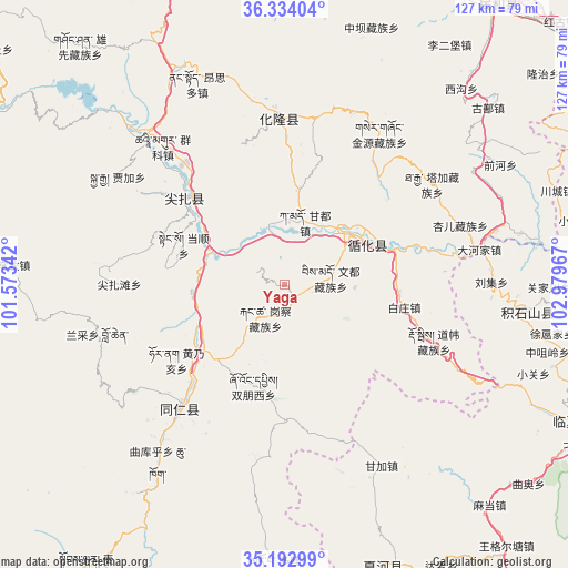
Yaga GPS coordinates[2]
35° 45' 56.016" North, 102° 16' 35.544" East
| Map corner | latitude | longitude |
|---|---|---|
| Upper-left | 36.33404°, | 101.57342° |
| Center: | 35.76556°, | 102.27654° |
| Lower-right: | 35.19299°, | 102.97967° |
| Map W x H: | 126.9×126.9 km | = 78.9×78.9mi |
| max Lat: | 53.31946° ⇑23.3% North |
| Yaga: | 35.76556° |
| min Lat: | ⇓76.7% South 18.22056° |
| min Long | Yaga | max Long |
| 75.07348° | 102.27654° | 134.28917° |
| W 7.5%⇐ | ⇒92.5% E |
Elevation
Elevation of Yaga is 2573 m = 8442 ft, and this is 2088.2 m = 6851 ft above average elevation for this country.
| Max E: |
5622 m = 18445 ft | 4% |
| Yaga | 2573 m 8442 ft | |
| Avg. | 484.8 m = 1591 ft | |
Min E: |
-3 m = -10 ft | 96% |
See also: China elevation on elevation.city.
Geographical zone
Yaga is located in North temperate zone (between Tropic of Cancer and the Arctic Circle). Distance of this Northern Tropic circle is 1370.8 km =851.8 mi to South.| Distance of | km | miles | from Yaga |
|---|---|---|---|
| North Pole | 6030.3 | 3747.1 | to North |
| Arctic Circle | 3424.4 | 2127.8 | to North |
| Tropic Cancer | 1370.8 | 851.8 | to South |
| Equator | 3976.8 | 2471.1 | to South |


Nearby cities:
15 places around Yaga: (largest is in red/bold)
• Angla
25.4 km =15.8 mi,  302°
302°
• Baizhuangji
27.3 km =17 mi,  100°
100°
• Bao’an
24.9 km =15.5 mi,  228°
228°
• Dangshun
24.3 km =15.1 mi,  291°
291°
• Dehenglong
26.1 km =16.2 mi,  332°
332°
• Galengkou
8.7 km =5.4 mi,  211°
211°
• Huangnaihai
29.6 km =18.4 mi,  235°
235°
• Jishi
20.6 km =12.8 mi,  64°
64°
• Laxiong
11 km =6.8 mi,  80°
80°
• Magitang
29.4 km =18.3 mi,  310°
310°
• Sanlanbahai
17.3 km =10.7 mi,  54°
54°
• Shixiang
24.9 km =15.5 mi,  72°
72°
• Shuangpengxi
23.8 km =14.8 mi,  197°
197°
• Xiazhuang
9.7 km =6 mi,  10°
10°
• Yaluhu
14.7 km =9.1 mi,  18°
18°
Sources, notices
• [Note1] Compared only with cities in China existing in our database
• [Src1] Map data: © OpenStreetMap contributors (CC-BY-SA)
• [Src2] Other city data from geonames.org with taken over terms of usage.
• [Src3] Geographical zone / Annual Mean Temperature by Robert A. Rohde @ Wikipedia
