Xiaoling geodata
Xiaoling (Gansu) is a seat of a fourth-order administrative division; located in China in Asia/Shanghai (GMT+8) time zone. In our database, there are 1268 cities with bigger population. Compared to other cities in China, 77% of cities are located further ↓South; 91.5% of cities are located further →East and 95.6% of cities have lower elevation than Xiaoling. Note1


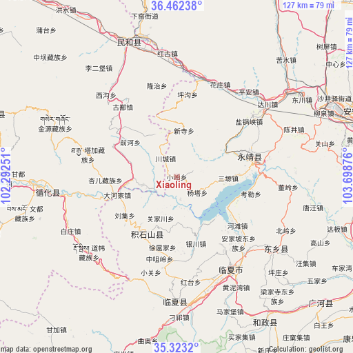
Xiaoling GPS coordinates[2]
35° 53' 41.424" North, 102° 59' 44.268" East
| Map corner | latitude | longitude |
|---|---|---|
| Upper-left | 36.46238°, | 102.29251° |
| Center: | 35.89484°, | 102.99563° |
| Lower-right: | 35.3232°, | 103.69876° |
| Map W x H: | 126.7×126.7 km | = 78.7×78.7mi |
| max Lat: | 53.31946° ⇑23% North |
| Xiaoling: | 35.89484° |
| min Lat: | ⇓77% South 18.22056° |
| min Long | Xiaoling | max Long |
| 75.07348° | 102.99563° | 134.28917° |
| W 8.5%⇐ | ⇒91.5% E |
Elevation
Elevation of Xiaoling is 2386 m = 7828 ft, and this is 1901.2 m = 6238 ft above average elevation for this country.
| Max E: |
5622 m = 18445 ft | 4.4% |
| Xiaoling | 2386 m 7828 ft | |
| Avg. | 484.8 m = 1591 ft | |
Min E: |
-3 m = -10 ft | 95.6% |
See also: China elevation on elevation.city.
Geographical zone
Xiaoling is located in North temperate zone (between Tropic of Cancer and the Arctic Circle). Distance of this Northern Tropic circle is 1385.2 km =860.7 mi to South.| Distance of | km | miles | from Xiaoling |
|---|---|---|---|
| North Pole | 6015.9 | 3738.1 | to North |
| Arctic Circle | 3410 | 2118.9 | to North |
| Tropic Cancer | 1385.2 | 860.7 | to South |
| Equator | 3991.1 | 2480 | to South |


Nearby cities:
15 places around Xiaoling: (largest is in red/bold)
• Chuimatan
22.5 km =14 mi,  209°
209°
• Dahejia
22.5 km =14 mi,  252°
252°
• Guanjiachuan
15.5 km =9.6 mi,  201°
201°
• Guanting
17.8 km =11.1 mi,  263°
263°
• Guogan
27 km =16.8 mi,  180°
180°
• Hulinjia
19.5 km =12.1 mi, 195°
• Lijiaping
22.8 km =14.2 mi,  294°
294°
• Liugou
21.1 km =13.1 mi,  217°
217°
• Liuji
23.1 km =14.4 mi,  233°
233°
• Shiyuan
23.2 km =14.4 mi, 227°
• Sibaozi
21.2 km =13.2 mi, 253°
• Wangjia
20.8 km =12.9 mi,  307°
307°
• Xinjia
14.2 km =8.8 mi, 261°
• Xuhujia
25.9 km =16.1 mi,  188°
188°
• Zhaizigou
25.9 km =16.1 mi, 201°
Sources, notices
• [Note1] Compared only with cities in China existing in our database
• [Src1] Map data: © OpenStreetMap contributors (CC-BY-SA)
• [Src2] Other city data from geonames.org with taken over terms of usage.
• [Src3] Geographical zone / Annual Mean Temperature by Robert A. Rohde @ Wikipedia
