Nawu geodata
Nawu (Gansu) is a seat of a fourth-order administrative division; located in China in Asia/Shanghai (GMT+8) time zone. In our database, there are 1268 cities with bigger population. Compared to other cities in China, 74.8% of cities are located further ↓South; 91.7% of cities are located further →East and 96.7% of cities have lower elevation than Nawu. Note1


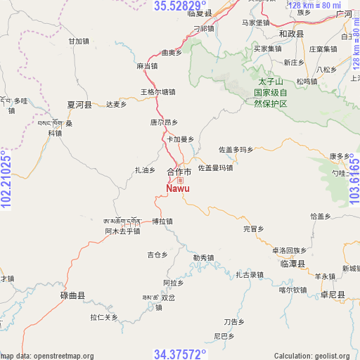
Nawu GPS coordinates[2]
34° 57' 14.508" North, 102° 54' 48.132" East
| Map corner | latitude | longitude |
|---|---|---|
| Upper-left | 35.52829°, | 102.21025° |
| Center: | 34.95403°, | 102.91337° |
| Lower-right: | 34.37572°, | 103.6165° |
| Map W x H: | 128.2×128.2 km | = 79.7×79.7mi |
| max Lat: | 53.31946° ⇑25.2% North |
| Nawu: | 34.95403° |
| min Lat: | ⇓74.8% South 18.22056° |
| min Long | Nawu | max Long |
| 75.07348° | 102.91337° | 134.28917° |
| W 8.3%⇐ | ⇒91.7% E |
Elevation
Elevation of Nawu is 2940 m = 9646 ft, and this is 2455.2 m = 8055 ft above average elevation for this country.
| Max E: |
5622 m = 18445 ft | 3.3% |
| Nawu | 2940 m 9646 ft | |
| Avg. | 484.8 m = 1591 ft | |
Min E: |
-3 m = -10 ft | 96.7% |
See also: China elevation on elevation.city.
Geographical zone
Nawu is located in North temperate zone (between Tropic of Cancer and the Arctic Circle). Distance of this Northern Tropic circle is 1280.6 km =795.7 mi to South.| Distance of | km | miles | from Nawu |
|---|---|---|---|
| North Pole | 6120.5 | 3803.1 | to North |
| Arctic Circle | 3514.7 | 2183.9 | to North |
| Tropic Cancer | 1280.6 | 795.7 | to South |
| Equator | 3886.5 | 2415 | to South |


Nearby cities:
15 places around Nawu: (largest is in red/bold)
• Damai
35.5 km =22.1 mi,  320°
320°
• Guzhan
45.3 km =28.1 mi,  129°
129°
• Hezuo
3.5 km =2.2 mi,  354°
354°
• Jiamaogong
29.1 km =18.1 mi,  144°
144°
• Jiujia
43.3 km =26.9 mi,  307°
307°
• Kajiadao
19.6 km =12.2 mi,  21°
21°
• Kajiaman
15 km =9.3 mi,  0°
0°
• Labuleng
45 km =28 mi, 307°
• Lexiu
28.5 km =17.7 mi,  163°
163°
• Madang
42.8 km =26.6 mi,  344°
344°
• Tangga’an
21.8 km =13.5 mi, 344°
• Wangge’ertang
32.8 km =20.4 mi, 347°
• Wanmao
31.3 km =19.4 mi,  123°
123°
• Zuogaiduoma
22.4 km =13.9 mi,  59°
59°
• Zuogaimanma
13.2 km =8.2 mi,  68°
68°
Sources, notices
• [Note1] Compared only with cities in China existing in our database
• [Src1] Map data: © OpenStreetMap contributors (CC-BY-SA)
• [Src2] Other city data from geonames.org with taken over terms of usage.
• [Src3] Geographical zone / Annual Mean Temperature by Robert A. Rohde @ Wikipedia
