Kajiaman geodata
Kajiaman (Gansu) is a seat of a fourth-order administrative division; located in China in Asia/Shanghai (GMT+8) time zone. In our database, there are 1268 cities with bigger population. Compared to other cities in China, 75.3% of cities are located further ↓South; 91.7% of cities are located further →East and 96.4% of cities have lower elevation than Kajiaman. Note1


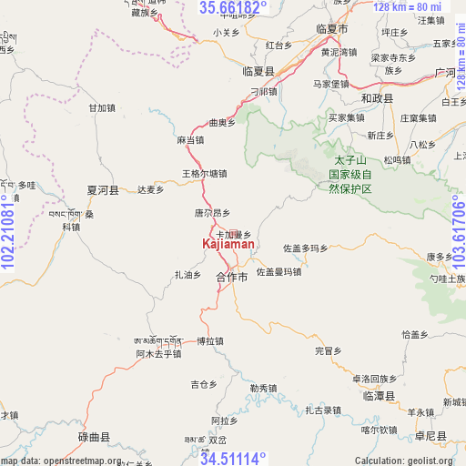
Kajiaman GPS coordinates[2]
35° 5' 18.636" North, 102° 54' 50.148" East
| Map corner | latitude | longitude |
|---|---|---|
| Upper-left | 35.66182°, | 102.21081° |
| Center: | 35.08851°, | 102.91393° |
| Lower-right: | 34.51114°, | 103.61706° |
| Map W x H: | 127.9×127.9 km | = 79.5×79.5mi |
| max Lat: | 53.31946° ⇑24.7% North |
| Kajiaman: | 35.08851° |
| min Lat: | ⇓75.3% South 18.22056° |
| min Long | Kajiaman | max Long |
| 75.07348° | 102.91393° | 134.28917° |
| W 8.3%⇐ | ⇒91.7% E |
Elevation
Elevation of Kajiaman is 2771 m = 9091 ft, and this is 2286.2 m = 7501 ft above average elevation for this country.
| Max E: |
5622 m = 18445 ft | 3.6% |
| Kajiaman | 2771 m 9091 ft | |
| Avg. | 484.8 m = 1591 ft | |
Min E: |
-3 m = -10 ft | 96.4% |
See also: China elevation on elevation.city.
Geographical zone
Kajiaman is located in North temperate zone (between Tropic of Cancer and the Arctic Circle). Distance of this Northern Tropic circle is 1295.6 km =805 mi to South.| Distance of | km | miles | from Kajiaman |
|---|---|---|---|
| North Pole | 6105.6 | 3793.8 | to North |
| Arctic Circle | 3499.7 | 2174.6 | to North |
| Tropic Cancer | 1295.6 | 805 | to South |
| Equator | 3901.5 | 2424.3 | to South |


Nearby cities:
15 places around Kajiaman: (largest is in red/bold)
• Damai
25.9 km =16.1 mi,  298°
298°
• Hezuo
11.5 km =7.1 mi,  182°
182°
• Jiamaogong
42.1 km =26.2 mi,  156°
156°
• Jiujia
36.3 km =22.6 mi,  288°
288°
• Kajiadao
7.9 km =4.9 mi,  66°
66°
• Labuleng
37.8 km =23.5 mi, 289°
• Madang
28.7 km =17.8 mi,  336°
336°
• Maji
40.5 km =25.2 mi,  9°
9°
• Nawu
15 km =9.3 mi, 180°
• Qu’ao
31.1 km =19.3 mi,  354°
354°
• Tangga’an
8.4 km =5.2 mi,  316°
316°
• Wangge’ertang
18.6 km =11.6 mi, 336°
• Wanmao
41.3 km =25.7 mi,  140°
140°
• Zuogaiduoma
19.6 km =12.2 mi,  100°
100°
• Zuogaimanma
15.9 km =9.9 mi,  129°
129°
Sources, notices
• [Note1] Compared only with cities in China existing in our database
• [Src1] Map data: © OpenStreetMap contributors (CC-BY-SA)
• [Src2] Other city data from geonames.org with taken over terms of usage.
• [Src3] Geographical zone / Annual Mean Temperature by Robert A. Rohde @ Wikipedia
