Tangga’an geodata
Tangga’an (Gansu) is a seat of a fourth-order administrative division; located in China in Asia/Shanghai (GMT+8) time zone. In our database, there are 1268 cities with bigger population. Compared to other cities in China, 75.3% of cities are located further ↓South; 91.8% of cities are located further →East and 96.1% of cities have lower elevation than Tangga’an. Note1


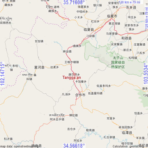
Tangga’an GPS coordinates[2]
35° 8' 35.376" North, 102° 51' 0.972" East
| Map corner | latitude | longitude |
|---|---|---|
| Upper-left | 35.71608°, | 102.14715° |
| Center: | 35.14316°, | 102.85027° |
| Lower-right: | 34.56618°, | 103.5534° |
| Map W x H: | 127.9×127.9 km | = 79.5×79.5mi |
| max Lat: | 53.31946° ⇑24.7% North |
| Tangga’an: | 35.14316° |
| min Lat: | ⇓75.3% South 18.22056° |
| min Long | Tangga’an | max Long |
| 75.07348° | 102.85027° | 134.28917° |
| W 8.2%⇐ | ⇒91.8% E |
Elevation
Elevation of Tangga’an is 2634 m = 8642 ft, and this is 2149.2 m = 7051 ft above average elevation for this country.
| Max E: |
5622 m = 18445 ft | 3.9% |
| Tangga’an | 2634 m 8642 ft | |
| Avg. | 484.8 m = 1591 ft | |
Min E: |
-3 m = -10 ft | 96.1% |
See also: China elevation on elevation.city.
Geographical zone
Tangga’an is located in North temperate zone (between Tropic of Cancer and the Arctic Circle). Distance of this Northern Tropic circle is 1301.6 km =808.8 mi to South.| Distance of | km | miles | from Tangga’an |
|---|---|---|---|
| North Pole | 6099.5 | 3790.1 | to North |
| Arctic Circle | 3493.6 | 2170.8 | to North |
| Tropic Cancer | 1301.6 | 808.8 | to South |
| Equator | 3907.6 | 2428.1 | to South |


Nearby cities:
15 places around Tangga’an: (largest is in red/bold)
• Damai
18.1 km =11.2 mi,  290°
290°
• Hezuo
18.3 km =11.4 mi,  162°
162°
• Jiujia
29.2 km =18.1 mi,  280°
280°
• Kajiadao
13.3 km =8.3 mi,  102°
102°
• Kajiaman
8.4 km =5.2 mi,  136°
136°
• Labuleng
30.6 km =19 mi, 282°
• Madang
21 km =13 mi,  343°
343°
• Maji
36.1 km =22.4 mi,  20°
20°
• Monigou
37.2 km =23.1 mi,  14°
14°
• Nawu
21.8 km =13.5 mi, 164°
• Qu’ao
25 km =15.5 mi, 5°
• Sangke
37 km =23 mi,  266°
266°
• Wangge’ertang
11.1 km =6.9 mi,  351°
351°
• Zuogaiduoma
26.9 km =16.7 mi,  111°
111°
• Zuogaimanma
24.3 km =15.1 mi,  131°
131°
Sources, notices
• [Note1] Compared only with cities in China existing in our database
• [Src1] Map data: © OpenStreetMap contributors (CC-BY-SA)
• [Src2] Other city data from geonames.org with taken over terms of usage.
• [Src3] Geographical zone / Annual Mean Temperature by Robert A. Rohde @ Wikipedia
