Labuleng geodata
Labuleng (Gansu) is a seat of a third-order administrative division; located in China in Asia/Shanghai (GMT+8) time zone. In our database, there are 1268 cities with bigger population. Compared to other cities in China, 75.4% of cities are located further ↓South; 92.3% of cities are located further →East and 96.7% of cities have lower elevation than Labuleng. Note1


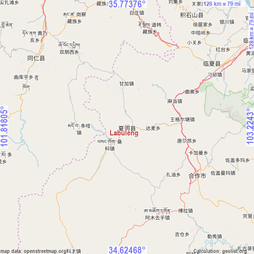
Labuleng GPS coordinates[2]
35° 12' 4.5" North, 102° 31' 16.212" East
| Map corner | latitude | longitude |
|---|---|---|
| Upper-left | 35.77376°, | 101.81805° |
| Center: | 35.20125°, | 102.52117° |
| Lower-right: | 34.62468°, | 103.2243° |
| Map W x H: | 127.8×127.8 km | = 79.4×79.4mi |
| max Lat: | 53.31946° ⇑24.6% North |
| Labuleng: | 35.20125° |
| min Lat: | ⇓75.4% South 18.22056° |
| min Long | Labuleng | max Long |
| 75.07348° | 102.52117° | 134.28917° |
| W 7.7%⇐ | ⇒92.3% E |
Elevation
Elevation of Labuleng is 2926 m = 9600 ft, and this is 2441.2 m = 8009 ft above average elevation for this country.
| Max E: |
5622 m = 18445 ft | 3.3% |
| Labuleng | 2926 m 9600 ft | |
| Avg. | 484.8 m = 1591 ft | |
Min E: |
-3 m = -10 ft | 96.7% |
See also: China elevation on elevation.city.
Geographical zone
Labuleng is located in North temperate zone (between Tropic of Cancer and the Arctic Circle). Distance of this Northern Tropic circle is 1308.1 km =812.8 mi to South.| Distance of | km | miles | from Labuleng |
|---|---|---|---|
| North Pole | 6093 | 3786 | to North |
| Arctic Circle | 3487.2 | 2166.8 | to North |
| Tropic Cancer | 1308.1 | 812.8 | to South |
| Equator | 3914 | 2432 | to South |


Nearby cities:
15 places around Labuleng: (largest is in red/bold)
• Damai
13 km =8.1 mi,  90°
90°
• Duowa
24.7 km =15.3 mi,  268°
268°
• Ganjia
22.2 km =13.8 mi,  358°
358°
• Hezuo
42.7 km =26.5 mi,  124°
124°
• Jiujia
1.7 km =1.1 mi,  135°
135°
• Kajiadao
43.9 km =27.3 mi,  102°
102°
• Kajiaman
37.8 km =23.5 mi,  109°
109°
• Madang
27.6 km =17.1 mi,  60°
60°
• Nawu
45 km =28 mi,  127°
127°
• Qu’ao
37.3 km =23.2 mi, 60°
• Sangke
11 km =6.8 mi,  219°
219°
• Sangke
39 km =24.2 mi,  253°
253°
• Tangga’an
30.6 km =19 mi, 102°
• Tawa
39.2 km =24.4 mi,  326°
326°
• Wangge’ertang
28.7 km =17.8 mi,  80°
80°
Sources, notices
• [Note1] Compared only with cities in China existing in our database
• [Src1] Map data: © OpenStreetMap contributors (CC-BY-SA)
• [Src2] Other city data from geonames.org with taken over terms of usage.
• [Src3] Geographical zone / Annual Mean Temperature by Robert A. Rohde @ Wikipedia
