Longmen geodata
Longmen (Jiangxi) is a seat of a fourth-order administrative division; located in China in Asia/Shanghai (GMT+8) time zone. In our database, there are 1268 cities with bigger population. Compared to other cities in China, 78.2% of cities are located further ↑North; 50.4% of cities are located further →East and 52.6% of cities have higher elevation than Longmen. Note1


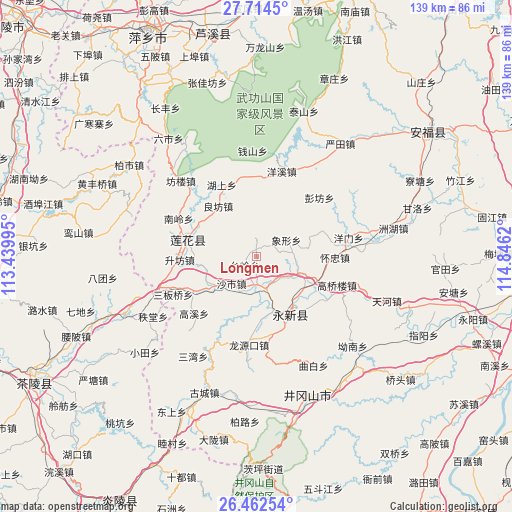
Longmen GPS coordinates[2]
27° 5' 24.972" North, 114° 8' 35.052" East
| Map corner | latitude | longitude |
|---|---|---|
| Upper-left | 27.7145°, | 113.43995° |
| Center: | 27.09027°, | 114.14307° |
| Lower-right: | 26.46254°, | 114.8462° |
| Map W x H: | 139.2×139.2 km | = 86.5×86.5mi |
| max Lat: | 53.31946° ⇑78.2% North |
| Longmen: | 27.09027° |
| min Lat: | ⇓21.8% South 18.22056° |
| min Long | Longmen | max Long |
| 75.07348° | 114.14307° | 134.28917° |
| W 49.6%⇐ | ⇒50.4% E |
Elevation
Elevation of Longmen is 146 m = 479 ft, and this is 338.8 m = 1112 ft below average elevation for this country.
| Max E: |
5622 m = 18445 ft | 52.6% |
| Avg. | 484.8 m = 1591 ft | |
| Longmen | 146 m = 479 ft | |
Min E: |
-3 m = -10 ft | 47.4% |
See also: China elevation on elevation.city.
Geographical zone
Longmen is located in North temperate zone (between Tropic of Cancer and the Arctic Circle). Distance of this Northern Tropic circle is 406.2 km =252.4 mi to South.| Distance of | km | miles | from Longmen |
|---|---|---|---|
| North Pole | 6994.9 | 4346.4 | to North |
| Arctic Circle | 4389 | 2727.2 | to North |
| Tropic Cancer | 406.2 | 252.4 | to South |
| Equator | 3012.2 | 1871.7 | to South |


Nearby cities:
15 places around Longmen: (largest is in red/bold)
• Gaoqiaolou
23.3 km =14.5 mi,  109°
109°
• Gaoshi
8.7 km =5.4 mi,  136°
136°
• Hechuan
19.1 km =11.9 mi,  153°
153°
• Huaizhong
21.4 km =13.3 mi,  90°
90°
• Hushang
21.6 km =13.4 mi,  334°
334°
• Liangfang
17.1 km =10.6 mi,  322°
322°
• Lianzhou
12.4 km =7.7 mi, 113°
• Litian
8.2 km =5.1 mi,  182°
182°
• Longtian
13.6 km =8.5 mi,  234°
234°
• Lukou
21.9 km =13.6 mi,  348°
348°
• Pengfang
23.5 km =14.6 mi,  47°
47°
• Qinting
19.6 km =12.2 mi,  281°
281°
• Shashi
10 km =6.2 mi,  222°
222°
• Tailing
4 km =2.5 mi, 232°
• Xiangxing
9.3 km =5.8 mi,  61°
61°
Sources, notices
• [Note1] Compared only with cities in China existing in our database
• [Src1] Map data: © OpenStreetMap contributors (CC-BY-SA)
• [Src2] Other city data from geonames.org with taken over terms of usage.
• [Src3] Geographical zone / Annual Mean Temperature by Robert A. Rohde @ Wikipedia
