Chengfang geodata
Chengfang (Jiangxi) is a seat of a fourth-order administrative division; located in China in Asia/Shanghai (GMT+8) time zone. In our database, there are 1268 cities with bigger population. Compared to other cities in China, 65.7% of cities are located further ↑North; 50.6% of cities are located further ←West and 60.1% of cities have lower elevation than Chengfang. Note1


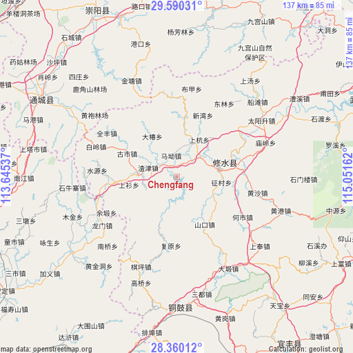
Chengfang GPS coordinates[2]
28° 58' 37.344" North, 114° 20' 54.564" East
| Map corner | latitude | longitude |
|---|---|---|
| Upper-left | 29.59031°, | 113.64537° |
| Center: | 28.97704°, | 114.34849° |
| Lower-right: | 28.36012°, | 115.05162° |
| Map W x H: | 136.8×136.8 km | = 85×85mi |
| max Lat: | 53.31946° ⇑65.7% North |
| Chengfang: | 28.97704° |
| min Lat: | ⇓34.3% South 18.22056° |
| min Long | Chengfang | max Long |
| 75.07348° | 114.34849° | 134.28917° |
| W 50.6%⇐ | ⇒49.4% E |
Elevation
Elevation of Chengfang is 260 m = 853 ft, and this is 224.8 m = 738 ft below average elevation for this country.
| Max E: |
5622 m = 18445 ft | 39.9% |
| Avg. | 484.8 m = 1591 ft | |
| Chengfang | 260 m = 853 ft | |
Min E: |
-3 m = -10 ft | 60.1% |
See also: China elevation on elevation.city.
Geographical zone
Chengfang is located in North temperate zone (between Tropic of Cancer and the Arctic Circle). Distance of this Northern Tropic circle is 616 km =382.8 mi to South.| Distance of | km | miles | from Chengfang |
|---|---|---|---|
| North Pole | 6785.1 | 4216.1 | to North |
| Arctic Circle | 4179.2 | 2596.8 | to North |
| Tropic Cancer | 616 | 382.8 | to South |
| Equator | 3221.9 | 2002 | to South |


Nearby cities:
15 places around Chengfang: (largest is in red/bold)
• Dachun
18.4 km =11.4 mi,  328°
328°
• Donggang
12.7 km =7.9 mi,  249°
249°
• Gushi
21.6 km =13.4 mi,  295°
295°
• Hangkou
12 km =7.5 mi,  49°
49°
• Manjiang
18 km =11.2 mi,  162°
162°
• Ma’ao
9 km =5.6 mi,  346°
346°
• Shanghang
16.8 km =10.4 mi,  30°
30°
• Shangshan
18.7 km =11.6 mi,  260°
260°
• Shankou
21.6 km =13.4 mi,  148°
148°
• Shi’ao
16 km =9.9 mi,  280°
280°
• Xigang
13.8 km =8.6 mi,  22°
22°
• Xikou
20.9 km =13 mi,  7°
7°
• Zhajin
11.5 km =7.1 mi,  288°
288°
• Zhengcun
17.8 km =11.1 mi,  98°
98°
• Zhuping
12.9 km =8 mi,  72°
72°
Sources, notices
• [Note1] Compared only with cities in China existing in our database
• [Src1] Map data: © OpenStreetMap contributors (CC-BY-SA)
• [Src2] Other city data from geonames.org with taken over terms of usage.
• [Src3] Geographical zone / Annual Mean Temperature by Robert A. Rohde @ Wikipedia
