Yinong geodata
Yinong (Zhejiang) is a seat of a fourth-order administrative division; located in China in Asia/Shanghai (GMT+8) time zone. In our database, there are 1268 cities with bigger population. Compared to other cities in China, 52.1% of cities are located further ↑North; 85.6% of cities are located further ←West and 89.9% of cities have higher elevation than Yinong. Note1


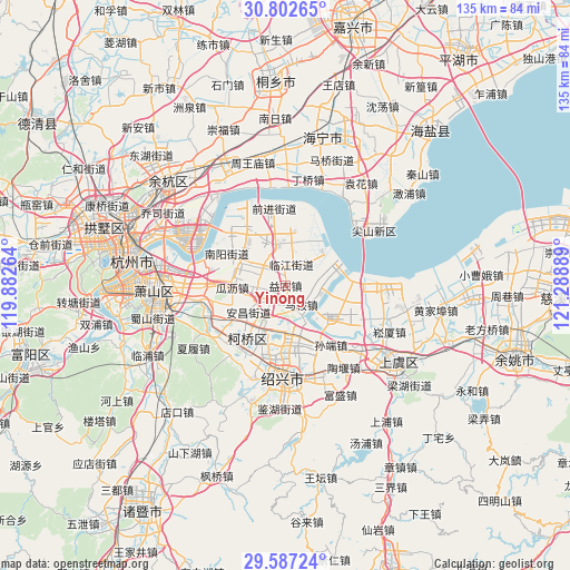
Yinong GPS coordinates[2]
30° 11' 48.552" North, 120° 35' 8.736" East
| Map corner | latitude | longitude |
|---|---|---|
| Upper-left | 30.80265°, | 119.88264° |
| Center: | 30.19682°, | 120.58576° |
| Lower-right: | 29.58724°, | 121.28889° |
| Map W x H: | 135.1×135.1 km | = 83.9×83.9mi |
| max Lat: | 53.31946° ⇑52.1% North |
| Yinong: | 30.19682° |
| min Lat: | ⇓47.9% South 18.22056° |
| min Long | Yinong | max Long |
| 75.07348° | 120.58576° | 134.28917° |
| W 85.6%⇐ | ⇒14.4% E |
Elevation
Elevation of Yinong is 10 m = 33 ft, and this is 474.8 m = 1558 ft below average elevation for this country.
| Max E: |
5622 m = 18445 ft | 89.9% |
| Avg. | 484.8 m = 1591 ft | |
| Yinong | 10 m = 33 ft | |
Min E: |
-3 m = -10 ft | 10.1% |
See also: China elevation on elevation.city.
Geographical zone
Yinong is located in North temperate zone (between Tropic of Cancer and the Arctic Circle). Distance of this Northern Tropic circle is 751.7 km =467.1 mi to South.| Distance of | km | miles | from Yinong |
|---|---|---|---|
| North Pole | 6649.5 | 4131.8 | to North |
| Arctic Circle | 4043.6 | 2512.6 | to North |
| Tropic Cancer | 751.7 | 467.1 | to South |
| Equator | 3357.6 | 2086.3 | to South |


Nearby cities:
15 places around Yinong: (largest is in red/bold)
• Anchang
11.5 km =7.1 mi,  237°
237°
• Dangshan
7.4 km =4.6 mi, 240°
• Dangwan
5.4 km =3.4 mi,  311°
311°
• Dongpu
16.5 km =10.3 mi,  198°
198°
• Doumen
11.1 km =6.9 mi,  176°
176°
• Guali
12.8 km =8 mi,  264°
264°
• Hezhuang
16.6 km =10.3 mi, 313°
• Huashe
13.7 km =8.5 mi,  226°
226°
• Jingjiang
12.5 km =7.8 mi,  288°
288°
• Mashan
14.8 km =9.2 mi,  151°
151°
• Ma’an
5.5 km =3.4 mi, 184°
• Nanyang
15.6 km =9.7 mi,  298°
298°
• Qixian
9.5 km =5.9 mi,  209°
209°
• Xinwan
10.2 km =6.3 mi,  333°
333°
• Yipeng
11.8 km =7.3 mi, 307°
Sources, notices
• [Note1] Compared only with cities in China existing in our database
• [Src1] Map data: © OpenStreetMap contributors (CC-BY-SA)
• [Src2] Other city data from geonames.org with taken over terms of usage.
• [Src3] Geographical zone / Annual Mean Temperature by Robert A. Rohde @ Wikipedia
