Huanglong geodata
Huanglong (Jiangxi) is a seat of a fourth-order administrative division; located in China in Asia/Shanghai (GMT+8) time zone. In our database, there are 1268 cities with bigger population. Compared to other cities in China, 65.1% of cities are located further ↑North; 51.2% of cities are located further →East and 62.7% of cities have lower elevation than Huanglong. Note1


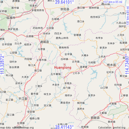
Huanglong GPS coordinates[2]
29° 1' 40.98" North, 114° 1' 54.624" East
| Map corner | latitude | longitude |
|---|---|---|
| Upper-left | 29.64101°, | 113.32872° |
| Center: | 29.02805°, | 114.03184° |
| Lower-right: | 28.41143°, | 114.73497° |
| Map W x H: | 136.7×136.7 km | = 84.9×84.9mi |
| max Lat: | 53.31946° ⇑65.1% North |
| Huanglong: | 29.02805° |
| min Lat: | ⇓34.9% South 18.22056° |
| min Long | Huanglong | max Long |
| 75.07348° | 114.03184° | 134.28917° |
| W 48.8%⇐ | ⇒51.2% E |
Elevation
Elevation of Huanglong is 292 m = 958 ft, and this is 192.8 m = 633 ft below average elevation for this country.
| Max E: |
5622 m = 18445 ft | 37.3% |
| Avg. | 484.8 m = 1591 ft | |
| Huanglong | 292 m = 958 ft | |
Min E: |
-3 m = -10 ft | 62.7% |
See also: China elevation on elevation.city.
Geographical zone
Huanglong is located in North temperate zone (between Tropic of Cancer and the Arctic Circle). Distance of this Northern Tropic circle is 621.7 km =386.3 mi to South.| Distance of | km | miles | from Huanglong |
|---|---|---|---|
| North Pole | 6779.4 | 4212.5 | to North |
| Arctic Circle | 4173.6 | 2593.4 | to North |
| Tropic Cancer | 621.7 | 386.3 | to South |
| Equator | 3227.6 | 2005.5 | to South |


Nearby cities:
15 places around Huanglong: (largest is in red/bold)
• Bailing
5.9 km =3.7 mi,  350°
350°
• Dachun
23.5 km =14.6 mi,  64°
64°
• Daqiao
10.6 km =6.6 mi,  135°
135°
• Donggang
21.4 km =13.3 mi,  118°
118°
• Gushi
11.9 km =7.4 mi,  71°
71°
• Longmen
24.4 km =15.2 mi,  175°
175°
• Lukou
8 km =5 mi,  43°
43°
• Maishi
17.4 km =10.8 mi,  335°
335°
• Quanfeng
11.8 km =7.3 mi,  18°
18°
• Shangshan
15.1 km =9.4 mi, 124°
• Shi’ao
15.3 km =9.5 mi,  100°
100°
• Shuiyuan
3.3 km =2.1 mi, 175°
• Tanghu
21.2 km =13.2 mi, 346°
• Yuduan
19.7 km =12.2 mi,  169°
169°
• Zhajin
20 km =12.4 mi, 95°
Sources, notices
• [Note1] Compared only with cities in China existing in our database
• [Src1] Map data: © OpenStreetMap contributors (CC-BY-SA)
• [Src2] Other city data from geonames.org with taken over terms of usage.
• [Src3] Geographical zone / Annual Mean Temperature by Robert A. Rohde @ Wikipedia
