Ruanyitu geodata
Ruanyitu (Hubei) is a seat of a fourth-order administrative division; located in China in Asia/Shanghai (GMT+8) time zone. In our database, there are 1268 cities with bigger population. Compared to other cities in China, 54.8% of cities are located further ↑North; 55.3% of cities are located further ←West and 57.4% of cities have higher elevation than Ruanyitu. Note1


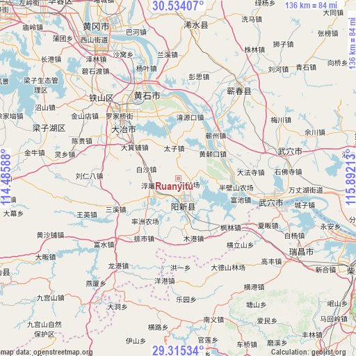
Ruanyitu GPS coordinates[2]
29° 55' 35.652" North, 115° 11' 20.4" East
| Map corner | latitude | longitude |
|---|---|---|
| Upper-left | 30.53407°, | 114.48588° |
| Center: | 29.92657°, | 115.189° |
| Lower-right: | 29.31534°, | 115.89213° |
| Map W x H: | 135.5×135.5 km | = 84.2×84.2mi |
| max Lat: | 53.31946° ⇑54.8% North |
| Ruanyitu: | 29.92657° |
| min Lat: | ⇓45.2% South 18.22056° |
| min Long | Ruanyitu | max Long |
| 75.07348° | 115.189° | 134.28917° |
| W 55.3%⇐ | ⇒44.7% E |
Elevation
Elevation of Ruanyitu is 115 m = 377 ft, and this is 369.8 m = 1213 ft below average elevation for this country.
| Max E: |
5622 m = 18445 ft | 57.4% |
| Avg. | 484.8 m = 1591 ft | |
| Ruanyitu | 115 m = 377 ft | |
Min E: |
-3 m = -10 ft | 42.6% |
See also: China elevation on elevation.city.
Geographical zone
Ruanyitu is located in North temperate zone (between Tropic of Cancer and the Arctic Circle). Distance of this Northern Tropic circle is 721.6 km =448.4 mi to South.| Distance of | km | miles | from Ruanyitu |
|---|---|---|---|
| North Pole | 6679.5 | 4150.4 | to North |
| Arctic Circle | 4073.7 | 2531.3 | to North |
| Tropic Cancer | 721.6 | 448.4 | to South |
| Equator | 3327.5 | 2067.6 | to South |


Nearby cities:
15 places around Ruanyitu: (largest is in red/bold)
• Baisha
12.6 km =7.8 mi,  287°
287°
• Dajipu
21.4 km =13.3 mi,  307°
307°
• Dawang
14.2 km =8.8 mi,  331°
331°
• Fuchi
25.3 km =15.7 mi,  108°
108°
• Futu
10.6 km =6.6 mi,  256°
256°
• Hekou
25 km =15.5 mi,  7°
7°
• Huangsangkou
16.6 km =10.3 mi,  53°
53°
• Mugang
23.3 km =14.5 mi,  166°
166°
• Qizhou
20.9 km =13 mi,  41°
41°
• Taizi
11.9 km =7.4 mi,  357°
357°
• Wangren
26 km =16.2 mi,  345°
345°
• Weiyuankou
23.4 km =14.5 mi, 10°
• Wuxue Shi
21.8 km =13.5 mi,  93°
93°
• Xingguo
10.5 km =6.5 mi, 169°
• Xingguo
10.9 km =6.8 mi, 92°
Sources, notices
• [Note1] Compared only with cities in China existing in our database
• [Src1] Map data: © OpenStreetMap contributors (CC-BY-SA)
• [Src2] Other city data from geonames.org with taken over terms of usage.
• [Src3] Geographical zone / Annual Mean Temperature by Robert A. Rohde @ Wikipedia
