Yuefeng geodata
Yuefeng (Fujian) is a seat of a fourth-order administrative division; located in China in Asia/Shanghai (GMT+8) time zone. In our database, there are 1268 cities with bigger population. Compared to other cities in China, 82% of cities are located further ↑North; 77.8% of cities are located further ←West and 88.7% of cities have higher elevation than Yuefeng. Note1


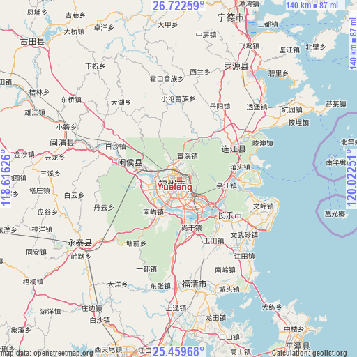
Yuefeng GPS coordinates[2]
26° 5' 34.224" North, 119° 19' 9.768" East
| Map corner | latitude | longitude |
|---|---|---|
| Upper-left | 26.72259°, | 118.61626° |
| Center: | 26.09284°, | 119.31938° |
| Lower-right: | 25.45968°, | 120.02251° |
| Map W x H: | 140.4×140.4 km | = 87.2×87.2mi |
| max Lat: | 53.31946° ⇑82% North |
| Yuefeng: | 26.09284° |
| min Lat: | ⇓18% South 18.22056° |
| min Long | Yuefeng | max Long |
| 75.07348° | 119.31938° | 134.28917° |
| W 77.8%⇐ | ⇒22.2% E |
Elevation
Elevation of Yuefeng is 11 m = 36 ft, and this is 473.8 m = 1554 ft below average elevation for this country.
| Max E: |
5622 m = 18445 ft | 88.7% |
| Avg. | 484.8 m = 1591 ft | |
| Yuefeng | 11 m = 36 ft | |
Min E: |
-3 m = -10 ft | 11.3% |
See also: China elevation on elevation.city.
Geographical zone
Yuefeng is located in North temperate zone (between Tropic of Cancer and the Arctic Circle). Distance of this Northern Tropic circle is 295.3 km =183.5 mi to South.| Distance of | km | miles | from Yuefeng |
|---|---|---|---|
| North Pole | 7105.8 | 4415.3 | to North |
| Arctic Circle | 4499.9 | 2796.1 | to North |
| Tropic Cancer | 295.3 | 183.5 | to South |
| Equator | 2901.3 | 1802.8 | to South |


Nearby cities:
15 places around Yuefeng: (largest is in red/bold)
• Antai
2.8 km =1.7 mi,  245°
245°
• Cangshan
6.2 km =3.9 mi,  190°
190°
• Chayuan
2.4 km =1.5 mi,  349°
349°
• Dongjie
2.5 km =1.6 mi,  258°
258°
• Fuzhou
3.7 km =2.3 mi,  200°
200°
• Gudong
2.3 km =1.4 mi,  270°
270°
• Gulou
2.2 km =1.4 mi, 251°
• Gushan
3.2 km =2 mi,  131°
131°
• Guxi
3.5 km =2.2 mi, 264°
• Hongshan
5.1 km =3.2 mi, 251°
• Huada
3.3 km =2.1 mi,  285°
285°
• Nanjie
3 km =1.9 mi, 257°
• Wenquan
1.8 km =1.1 mi,  296°
296°
• Wufeng
4.3 km =2.7 mi, 288°
• Xindian
3.7 km =2.3 mi,  331°
331°
Sources, notices
• [Note1] Compared only with cities in China existing in our database
• [Src1] Map data: © OpenStreetMap contributors (CC-BY-SA)
• [Src2] Other city data from geonames.org with taken over terms of usage.
• [Src3] Geographical zone / Annual Mean Temperature by Robert A. Rohde @ Wikipedia
