Yuanhe geodata
Yuanhe (Jiangsu) is a seat of a third-order administrative division; located in China in Asia/Shanghai (GMT+8) time zone. In our database, there are 1268 cities with bigger population. Compared to other cities in China, 57.7% of cities are located further ↓South; 85.8% of cities are located further ←West and 98.9% of cities have higher elevation than Yuanhe. Note1


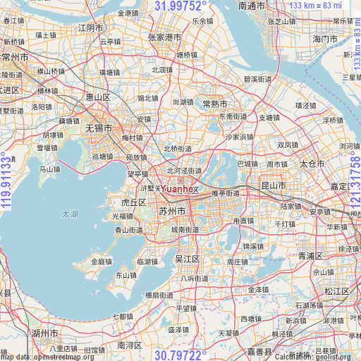
Yuanhe GPS coordinates[2]
31° 23' 57.444" North, 120° 36' 52.02" East
| Map corner | latitude | longitude |
|---|---|---|
| Upper-left | 31.99752°, | 119.91133° |
| Center: | 31.39929°, | 120.61445° |
| Lower-right: | 30.79722°, | 121.31758° |
| Map W x H: | 133.5×133.5 km | = 83×83mi |
| max Lat: | 53.31946° ⇑42.3% North |
| Yuanhe: | 31.39929° |
| min Lat: | ⇓57.7% South 18.22056° |
| min Long | Yuanhe | max Long |
| 75.07348° | 120.61445° | 134.28917° |
| W 85.8%⇐ | ⇒14.2% E |
Elevation
Elevation of Yuanhe is 3 m = 10 ft, and this is 481.8 m = 1581 ft below average elevation for this country.
| Max E: |
5622 m = 18445 ft | 98.9% |
| Avg. | 484.8 m = 1591 ft | |
| Yuanhe | 3 m = 10 ft | |
Min E: |
-3 m = -10 ft | 1.1% |
See also: China elevation on elevation.city.
Geographical zone
Yuanhe is located in North temperate zone (between Tropic of Cancer and the Arctic Circle). Distance of this Northern Tropic circle is 885.4 km =550.2 mi to South.| Distance of | km | miles | from Yuanhe |
|---|---|---|---|
| North Pole | 6515.8 | 4048.7 | to North |
| Arctic Circle | 3909.9 | 2429.5 | to North |
| Tropic Cancer | 885.4 | 550.2 | to South |
| Equator | 3491.3 | 2169.4 | to South |


Nearby cities:
15 places around Yuanhe: (largest is in red/bold)
• Baiyangwan
8.9 km =5.5 mi,  230°
230°
• Beiqiao
12.3 km =7.6 mi,  351°
351°
• Fengqiao
11.4 km =7.1 mi,  213°
213°
• Huangdai
6.9 km =4.3 mi,  306°
306°
• Loufeng
12.8 km =8 mi,  160°
160°
• Pingjianglu
9.5 km =5.9 mi,  171°
171°
• Shilu
9.9 km =6.2 mi,  191°
191°
• Shishan
12.1 km =7.5 mi,  202°
202°
• Shuangta
10.7 km =6.6 mi, 172°
• Suzhou
10.7 km =6.6 mi, 189°
• Taiping
8.8 km =5.5 mi,  63°
63°
• Weitang
7.9 km =4.9 mi,  21°
21°
• Weiting
9.6 km =6 mi,  127°
127°
• Xushuguan
11.2 km =7 mi,  259°
259°
• Yangdenghu
14.7 km =9.1 mi,  44°
44°
Sources, notices
• [Note1] Compared only with cities in China existing in our database
• [Src1] Map data: © OpenStreetMap contributors (CC-BY-SA)
• [Src2] Other city data from geonames.org with taken over terms of usage.
• [Src3] Geographical zone / Annual Mean Temperature by Robert A. Rohde @ Wikipedia
