Dashu geodata
Dashu (Chongqing) is a seat of a fourth-order administrative division; located in China in Asia/Shanghai (GMT+8) time zone. In our database, there are 1268 cities with bigger population. Compared to other cities in China, 56.4% of cities are located further ↓South; 74.7% of cities are located further →East and 69.3% of cities have lower elevation than Dashu. Note1


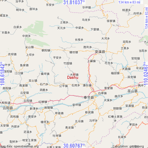
Dashu GPS coordinates[2]
31° 12' 39.348" North, 109° 19' 17.544" East
| Map corner | latitude | longitude |
|---|---|---|
| Upper-left | 31.81037°, | 108.61842° |
| Center: | 31.21093°, | 109.32154° |
| Lower-right: | 30.60767°, | 110.02467° |
| Map W x H: | 133.7×133.7 km | = 83.1×83.1mi |
| max Lat: | 53.31946° ⇑43.6% North |
| Dashu: | 31.21093° |
| min Lat: | ⇓56.4% South 18.22056° |
| min Long | Dashu | max Long |
| 75.07348° | 109.32154° | 134.28917° |
| W 25.3%⇐ | ⇒74.7% E |
Elevation
Elevation of Dashu is 398 m = 1306 ft, and this is 86.8 m = 285 ft below average elevation for this country.
| Max E: |
5622 m = 18445 ft | 30.7% |
| Avg. | 484.8 m = 1591 ft | |
| Dashu | 398 m = 1306 ft | |
Min E: |
-3 m = -10 ft | 69.3% |
See also: China elevation on elevation.city.
Geographical zone
Dashu is located in North temperate zone (between Tropic of Cancer and the Arctic Circle). Distance of this Northern Tropic circle is 864.4 km =537.1 mi to South.| Distance of | km | miles | from Dashu |
|---|---|---|---|
| North Pole | 6536.7 | 4061.7 | to North |
| Arctic Circle | 3930.8 | 2442.5 | to North |
| Tropic Cancer | 864.4 | 537.1 | to South |
| Equator | 3470.3 | 2156.3 | to South |


Nearby cities:
15 places around Dashu: (largest is in red/bold)
• Fenhe
20.8 km =12.9 mi,  113°
113°
• Gongping
15.1 km =9.4 mi,  231°
231°
• Gulu
17.4 km =10.8 mi,  40°
40°
• Hongtu
23.4 km =14.5 mi,  245°
245°
• Kangle
15 km =9.3 mi,  136°
136°
• Ping’an
22 km =13.7 mi,  314°
314°
• Pulian
24.8 km =15.4 mi,  66°
66°
• Shanghuang
19.7 km =12.2 mi,  51°
51°
• Shigang
9.3 km =5.8 mi,  153°
153°
• Tangfang
20.3 km =12.6 mi,  356°
356°
• Wenfeng
23.1 km =14.4 mi,  339°
339°
• Xinzheng
20.3 km =12.6 mi,  278°
278°
• Yanwan
19.9 km =12.4 mi,  94°
94°
• Yong’an
24.9 km =15.5 mi, 148°
• Zhuyuan
11.8 km =7.3 mi,  329°
329°
Sources, notices
• [Note1] Compared only with cities in China existing in our database
• [Src1] Map data: © OpenStreetMap contributors (CC-BY-SA)
• [Src2] Other city data from geonames.org with taken over terms of usage.
• [Src3] Geographical zone / Annual Mean Temperature by Robert A. Rohde @ Wikipedia
