Baiquan geodata
Baiquan (Chongqing) is a seat of a fourth-order administrative division; located in China in Asia/Shanghai (GMT+8) time zone. In our database, there are 1268 cities with bigger population. Compared to other cities in China, 58.9% of cities are located further ↓South; 77.3% of cities are located further →East and 83.7% of cities have lower elevation than Baiquan. Note1


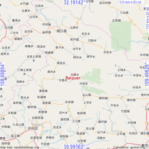
Baiquan GPS coordinates[2]
31° 35' 40.02" North, 108° 46' 59.376" East
| Map corner | latitude | longitude |
|---|---|---|
| Upper-left | 32.19142°, | 108.08004° |
| Center: | 31.59445°, | 108.78316° |
| Lower-right: | 30.99363°, | 109.48629° |
| Map W x H: | 133.2×133.2 km | = 82.8×82.8mi |
| max Lat: | 53.31946° ⇑41.1% North |
| Baiquan: | 31.59445° |
| min Lat: | ⇓58.9% South 18.22056° |
| min Long | Baiquan | max Long |
| 75.07348° | 108.78316° | 134.28917° |
| W 22.7%⇐ | ⇒77.3% E |
Elevation
Elevation of Baiquan is 901 m = 2956 ft, and this is 416.2 m = 1365 ft above average elevation for this country.
| Max E: |
5622 m = 18445 ft | 16.3% |
| Baiquan | 901 m 2956 ft | |
| Avg. | 484.8 m = 1591 ft | |
Min E: |
-3 m = -10 ft | 83.7% |
See also: China elevation on elevation.city.
Geographical zone
Baiquan is located in North temperate zone (between Tropic of Cancer and the Arctic Circle). Distance of this Northern Tropic circle is 907.1 km =563.6 mi to South.| Distance of | km | miles | from Baiquan |
|---|---|---|---|
| North Pole | 6494.1 | 4035.2 | to North |
| Arctic Circle | 3888.2 | 2416 | to North |
| Tropic Cancer | 907.1 | 563.6 | to South |
| Equator | 3513 | 2182.9 | to South |


Nearby cities:
15 places around Baiquan: (largest is in red/bold)
• Gaoguan
30.1 km =18.7 mi,  19°
19°
• Guanmian
11.7 km =7.3 mi,  246°
246°
• Heyan
28.5 km =17.7 mi,  201°
201°
• Houping
21.8 km =13.5 mi,  41°
41°
• Jianshan
20.8 km =12.9 mi,  149°
149°
• Jiwu
22 km =13.7 mi,  307°
307°
• Liaozi
27.8 km =17.3 mi,  331°
331°
• Manyue
20.9 km =13 mi,  277°
277°
• Mingzhong
15.7 km =9.8 mi,  11°
11°
• Nongba
24.5 km =15.2 mi,  189°
189°
• Shashi
30.3 km =18.8 mi,  161°
161°
• Tianba
22.8 km =14.2 mi, 160°
• Tuba
27.4 km =17 mi, 154°
• Xianyi
16.1 km =10 mi, 310°
• Zhonggang
11.3 km =7 mi,  133°
133°
Sources, notices
• [Note1] Compared only with cities in China existing in our database
• [Src1] Map data: © OpenStreetMap contributors (CC-BY-SA)
• [Src2] Other city data from geonames.org with taken over terms of usage.
• [Src3] Geographical zone / Annual Mean Temperature by Robert A. Rohde @ Wikipedia
