Tuba geodata
Tuba (Chongqing) is a seat of a fourth-order administrative division; located in China in Asia/Shanghai (GMT+8) time zone. In our database, there are 1268 cities with bigger population. Compared to other cities in China, 57.5% of cities are located further ↓South; 76.7% of cities are located further →East and 85.2% of cities have lower elevation than Tuba. Note1


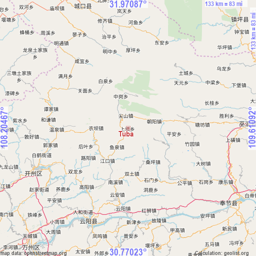
Tuba GPS coordinates[2]
31° 22' 20.892" North, 108° 54' 28.044" East
| Map corner | latitude | longitude |
|---|---|---|
| Upper-left | 31.97087°, | 108.20467° |
| Center: | 31.37247°, | 108.90779° |
| Lower-right: | 30.77023°, | 109.61092° |
| Map W x H: | 133.5×133.5 km | = 83×83mi |
| max Lat: | 53.31946° ⇑42.5% North |
| Tuba: | 31.37247° |
| min Lat: | ⇓57.5% South 18.22056° |
| min Long | Tuba | max Long |
| 75.07348° | 108.90779° | 134.28917° |
| W 23.3%⇐ | ⇒76.7% E |
Elevation
Elevation of Tuba is 997 m = 3271 ft, and this is 512.2 m = 1680 ft above average elevation for this country.
| Max E: |
5622 m = 18445 ft | 14.8% |
| Tuba | 997 m 3271 ft | |
| Avg. | 484.8 m = 1591 ft | |
Min E: |
-3 m = -10 ft | 85.2% |
See also: China elevation on elevation.city.
Geographical zone
Tuba is located in North temperate zone (between Tropic of Cancer and the Arctic Circle). Distance of this Northern Tropic circle is 882.4 km =548.3 mi to South.| Distance of | km | miles | from Tuba |
|---|---|---|---|
| North Pole | 6518.8 | 4050.6 | to North |
| Arctic Circle | 3912.9 | 2431.4 | to North |
| Tropic Cancer | 882.4 | 548.3 | to South |
| Equator | 3488.3 | 2167.5 | to South |


Nearby cities:
15 places around Tuba: (largest is in red/bold)
• Chaoyangdong
14.7 km =9.1 mi,  75°
75°
• Heyan
22.6 km =14 mi,  265°
265°
• Houye
23.8 km =14.8 mi,  247°
247°
• Jiangkou
19.9 km =12.4 mi,  212°
212°
• Jianshan
6.9 km =4.3 mi,  350°
350°
• Luyang
25.7 km =16 mi,  233°
233°
• Nongba
16 km =9.9 mi, 272°
• Ping’an
23.7 km =14.7 mi,  96°
96°
• Sangping
21.5 km =13.4 mi,  142°
142°
• Shashi
4.6 km =2.9 mi, 209°
• Taiyang
25.2 km =15.7 mi,  157°
157°
• Tianba
5.3 km =3.3 mi,  306°
306°
• Xinzheng
24.4 km =15.2 mi,  127°
127°
• Yuquan
11.2 km =7 mi, 209°
• Zhonggang
17.2 km =10.7 mi, 347°
Sources, notices
• [Note1] Compared only with cities in China existing in our database
• [Src1] Map data: © OpenStreetMap contributors (CC-BY-SA)
• [Src2] Other city data from geonames.org with taken over terms of usage.
• [Src3] Geographical zone / Annual Mean Temperature by Robert A. Rohde @ Wikipedia
