Lizi geodata
Lizi (Chongqing) is a seat of a fourth-order administrative division; located in China in Asia/Shanghai (GMT+8) time zone. In our database, there are 1268 cities with bigger population. Compared to other cities in China, 56.2% of cities are located further ↑North; 80.8% of cities are located further →East and 82.6% of cities have lower elevation than Lizi. Note1


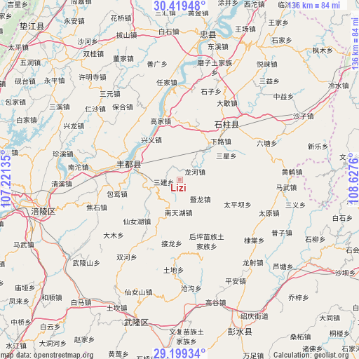
Lizi GPS coordinates[2]
29° 48' 40.572" North, 107° 55' 28.092" East
| Map corner | latitude | longitude |
|---|---|---|
| Upper-left | 30.41948°, | 107.22135° |
| Center: | 29.81127°, | 107.92447° |
| Lower-right: | 29.19934°, | 108.6276° |
| Map W x H: | 135.7×135.7 km | = 84.3×84.3mi |
| max Lat: | 53.31946° ⇑56.2% North |
| Lizi: | 29.81127° |
| min Lat: | ⇓43.8% South 18.22056° |
| min Long | Lizi | max Long |
| 75.07348° | 107.92447° | 134.28917° |
| W 19.2%⇐ | ⇒80.8% E |
Elevation
Elevation of Lizi is 823 m = 2700 ft, and this is 338.2 m = 1110 ft above average elevation for this country.
| Max E: |
5622 m = 18445 ft | 17.4% |
| Lizi | 823 m 2700 ft | |
| Avg. | 484.8 m = 1591 ft | |
Min E: |
-3 m = -10 ft | 82.6% |
See also: China elevation on elevation.city.
Geographical zone
Lizi is located in North temperate zone (between Tropic of Cancer and the Arctic Circle). Distance of this Northern Tropic circle is 708.8 km =440.4 mi to South.| Distance of | km | miles | from Lizi |
|---|---|---|---|
| North Pole | 6692.4 | 4158.5 | to North |
| Arctic Circle | 4086.5 | 2539.2 | to North |
| Tropic Cancer | 708.8 | 440.4 | to South |
| Equator | 3314.7 | 2059.7 | to South |


Nearby cities:
15 places around Lizi: (largest is in red/bold)
• Gaojia
24.1 km =15 mi,  345°
345°
• Jiangchi
15.1 km =9.4 mi,  40°
40°
• Jielong
24.1 km =15 mi,  186°
186°
• Jilong
12.5 km =7.8 mi,  141°
141°
• Longhe
6.6 km =4.1 mi,  61°
61°
• Nantianhu
12.3 km =7.6 mi,  181°
181°
• Sanba
22.3 km =13.9 mi,  226°
226°
• Sanhe
19.8 km =12.3 mi,  288°
288°
• Sanjian
5.9 km =3.7 mi,  263°
263°
• Sanxing
20.1 km =12.5 mi, 61°
• Shuanglu
15.6 km =9.7 mi, 292°
• Taipingba
23.7 km =14.7 mi,  112°
112°
• Wuping
15.6 km =9.7 mi,  96°
96°
• Xialu
21.2 km =13.2 mi,  46°
46°
• Xingyi
19.1 km =11.9 mi,  327°
327°
Sources, notices
• [Note1] Compared only with cities in China existing in our database
• [Src1] Map data: © OpenStreetMap contributors (CC-BY-SA)
• [Src2] Other city data from geonames.org with taken over terms of usage.
• [Src3] Geographical zone / Annual Mean Temperature by Robert A. Rohde @ Wikipedia
