Erlang geodata
Erlang (Chongqing) is a seat of a fourth-order administrative division; located in China in Asia/Shanghai (GMT+8) time zone. In our database, there are 1268 cities with bigger population. Compared to other cities in China, 50.7% of cities are located further ↑North; 86.9% of cities are located further →East and 65.2% of cities have lower elevation than Erlang. Note1


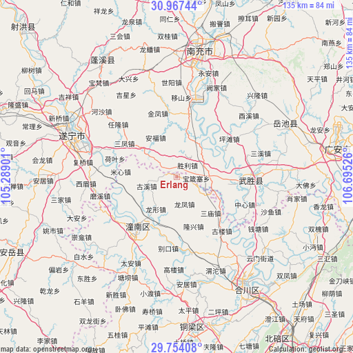
Erlang GPS coordinates[2]
30° 21' 45.504" North, 105° 59' 31.668" East
| Map corner | latitude | longitude |
|---|---|---|
| Upper-left | 30.96744°, | 105.28901° |
| Center: | 30.36264°, | 105.99213° |
| Lower-right: | 29.75408°, | 106.69526° |
| Map W x H: | 134.9×134.9 km | = 83.8×83.8mi |
| max Lat: | 53.31946° ⇑50.7% North |
| Erlang: | 30.36264° |
| min Lat: | ⇓49.3% South 18.22056° |
| min Long | Erlang | max Long |
| 75.07348° | 105.99213° | 134.28917° |
| W 13.1%⇐ | ⇒86.9% E |
Elevation
Elevation of Erlang is 331 m = 1086 ft, and this is 153.8 m = 505 ft below average elevation for this country.
| Max E: |
5622 m = 18445 ft | 34.8% |
| Avg. | 484.8 m = 1591 ft | |
| Erlang | 331 m = 1086 ft | |
Min E: |
-3 m = -10 ft | 65.2% |
See also: China elevation on elevation.city.
Geographical zone
Erlang is located in North temperate zone (between Tropic of Cancer and the Arctic Circle). Distance of this Northern Tropic circle is 770.1 km =478.5 mi to South.| Distance of | km | miles | from Erlang |
|---|---|---|---|
| North Pole | 6631.1 | 4120.4 | to North |
| Arctic Circle | 4025.2 | 2501.1 | to North |
| Tropic Cancer | 770.1 | 478.5 | to South |
| Equator | 3376 | 2097.7 | to South |


Nearby cities:
15 places around Erlang: (largest is in red/bold)
• Baolong
6.9 km =4.3 mi,  262°
262°
• Biekou
27.6 km =17.1 mi,  186°
186°
• Gulou
27 km =16.8 mi,  140°
140°
• Guxi
12.1 km =7.5 mi,  252°
252°
• Longfeng
10.9 km =6.8 mi,  164°
164°
• Longxing
14.8 km =9.2 mi,  212°
212°
• Longxing
20 km =12.4 mi, 161°
• Mixin
21.6 km =13.4 mi,  275°
275°
• Qunli
16.3 km =10.1 mi, 245°
• Sanmiao
19 km =11.8 mi, 137°
• Shanghe
23.2 km =14.4 mi, 193°
• Yankou
28.3 km =17.6 mi,  92°
92°
• Yanwo
8.5 km =5.3 mi,  113°
113°
• Yuxi
21 km =13 mi, 258°
• Zitong
25.8 km =16 mi,  217°
217°
Sources, notices
• [Note1] Compared only with cities in China existing in our database
• [Src1] Map data: © OpenStreetMap contributors (CC-BY-SA)
• [Src2] Other city data from geonames.org with taken over terms of usage.
• [Src3] Geographical zone / Annual Mean Temperature by Robert A. Rohde @ Wikipedia
