Erping geodata
Erping (Chongqing) is a seat of a fourth-order administrative division; located in China in Asia/Shanghai (GMT+8) time zone. In our database, there are 1268 cities with bigger population. Compared to other cities in China, 55.1% of cities are located further ↑North; 86.3% of cities are located further →East and 63.3% of cities have lower elevation than Erping. Note1


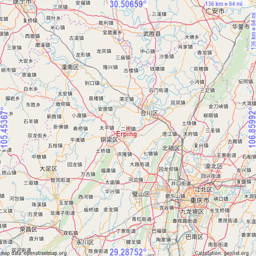
Erping GPS coordinates[2]
29° 53' 56.112" North, 106° 9' 24.444" East
| Map corner | latitude | longitude |
|---|---|---|
| Upper-left | 30.50659°, | 105.45367° |
| Center: | 29.89892°, | 106.15679° |
| Lower-right: | 29.28752°, | 106.85992° |
| Map W x H: | 135.5×135.5 km | = 84.2×84.2mi |
| max Lat: | 53.31946° ⇑55.1% North |
| Erping: | 29.89892° |
| min Lat: | ⇓44.9% South 18.22056° |
| min Long | Erping | max Long |
| 75.07348° | 106.15679° | 134.28917° |
| W 13.7%⇐ | ⇒86.3% E |
Elevation
Elevation of Erping is 302 m = 991 ft, and this is 182.8 m = 600 ft below average elevation for this country.
| Max E: |
5622 m = 18445 ft | 36.7% |
| Avg. | 484.8 m = 1591 ft | |
| Erping | 302 m = 991 ft | |
Min E: |
-3 m = -10 ft | 63.3% |
See also: China elevation on elevation.city.
Geographical zone
Erping is located in North temperate zone (between Tropic of Cancer and the Arctic Circle). Distance of this Northern Tropic circle is 718.5 km =446.5 mi to South.| Distance of | km | miles | from Erping |
|---|---|---|---|
| North Pole | 6682.6 | 4152.4 | to North |
| Arctic Circle | 4076.7 | 2533.1 | to North |
| Tropic Cancer | 718.5 | 446.5 | to South |
| Equator | 3324.4 | 2065.7 | to South |


Nearby cities:
15 places around Erping: (largest is in red/bold)
• Bachuan
11.7 km =7.3 mi,  241°
241°
• Baiyang
10 km =6.2 mi,  313°
313°
• Batang
14.9 km =9.3 mi,  118°
118°
• Diaoyucheng
15.3 km =9.5 mi,  43°
43°
• Dongcheng
9.9 km =6.2 mi,  234°
234°
• Hechuan
14.7 km =9.1 mi,  45°
45°
• Jiuxian
6 km =3.7 mi,  132°
132°
• Nancheng
12.3 km =7.6 mi, 235°
• Nanjin
14.2 km =8.8 mi, 47°
• Pulü
9 km =5.6 mi,  178°
178°
• Qinglong
13.6 km =8.5 mi,  188°
188°
• Shuikou
5.5 km =3.4 mi, 309°
• Taiping
11.4 km =7.1 mi,  272°
272°
• Tongxi
11.6 km =7.2 mi,  347°
347°
• Yangcheng
14.7 km =9.1 mi, 40°
Sources, notices
• [Note1] Compared only with cities in China existing in our database
• [Src1] Map data: © OpenStreetMap contributors (CC-BY-SA)
• [Src2] Other city data from geonames.org with taken over terms of usage.
• [Src3] Geographical zone / Annual Mean Temperature by Robert A. Rohde @ Wikipedia
