Taha Man Zu geodata
Taha Man Zu (Heilongjiang) is a seat of a fourth-order administrative division; located in China in Asia/Shanghai (GMT+8) time zone. In our database, there are 1268 cities with bigger population. Compared to other cities in China, 98% of cities are located further ↓South; 94.1% of cities are located further ←West and 51% of cities have higher elevation than Taha Man Zu. Note1


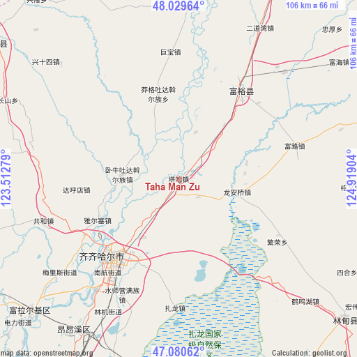
Taha Man Zu GPS coordinates[2]
47° 33' 26.208" North, 124° 12' 57.276" East
| Map corner | latitude | longitude |
|---|---|---|
| Upper-left | 48.02964°, | 123.51279° |
| Center: | 47.55728°, | 124.21591° |
| Lower-right: | 47.08062°, | 124.91904° |
| Map W x H: | 105.5×105.5 km | = 65.6×65.6mi |
| max Lat: | 53.31946° ⇑2% North |
| Taha Man Zu: | 47.55728° |
| min Lat: | ⇓98% South 18.22056° |
| min Long | Taha Man Zu | max Long |
| 75.07348° | 124.21591° | 134.28917° |
| W 94.1%⇐ | ⇒5.9% E |
Elevation
Elevation of Taha Man Zu is 156 m = 512 ft, and this is 328.8 m = 1079 ft below average elevation for this country.
| Max E: |
5622 m = 18445 ft | 51% |
| Avg. | 484.8 m = 1591 ft | |
| Taha Man Zu | 156 m = 512 ft | |
Min E: |
-3 m = -10 ft | 49% |
See also: China elevation on elevation.city.
Geographical zone
Taha Man Zu is located in North temperate zone (between Tropic of Cancer and the Arctic Circle). Distance of this North polar circle is 2113.3 km =1313.1 mi to North.| Distance of | km | miles | from Taha Man Zu |
|---|---|---|---|
| North Pole | 4719.2 | 2932.4 | to North |
| Arctic Circle | 2113.3 | 1313.1 | to North |
| Tropic Cancer | 2682 | 1666.5 | to South |
| Equator | 5287.9 | 3285.7 | to South |


Nearby cities:
15 places around Taha Man Zu: (largest is in red/bold)
• Bukui
30 km =18.6 mi,  221°
221°
• Dahudian
30.6 km =19 mi,  264°
264°
• Fanrong
34.7 km =21.6 mi,  122°
122°
• Fulu
35.9 km =22.3 mi,  74°
74°
• Fuyu
32.3 km =20.1 mi,  34°
34°
• Jubao
37.6 km =23.4 mi,  356°
356°
• Longhua
30.1 km =18.7 mi, 216°
• Long’anqiao
17.7 km =11 mi,  104°
104°
• Manggetu Dawo’er Zu
25.8 km =16 mi,  346°
346°
• Nanhang
33.7 km =20.9 mi, 216°
• Qiqihar
30.8 km =19.1 mi, 218°
• Ruiting
35.8 km =22.2 mi,  285°
285°
• Woniutu
17.2 km =10.7 mi,  271°
271°
• Ya’ersai
26.7 km =16.6 mi,  242°
242°
• Zhalong
38.4 km =23.9 mi,  181°
181°
Sources, notices
• [Note1] Compared only with cities in China existing in our database
• [Src1] Map data: © OpenStreetMap contributors (CC-BY-SA)
• [Src2] Other city data from geonames.org with taken over terms of usage.
• [Src3] Geographical zone / Annual Mean Temperature by Robert A. Rohde @ Wikipedia
