Bulongji geodata
Bulongji (Gansu) is a seat of a fourth-order administrative division; located in China in Asia/Urumqi (GMT+6) time zone. In our database, there are 1268 cities with bigger population. Compared to other cities in China, 88.1% of cities are located further ↓South; 95.8% of cities are located further →East and 89.8% of cities have lower elevation than Bulongji. Note1


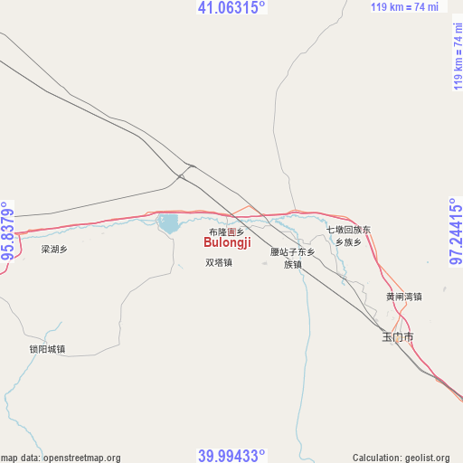
Bulongji GPS coordinates[2]
40° 31' 51.132" North, 96° 32' 27.672" East
| Map corner | latitude | longitude |
|---|---|---|
| Upper-left | 41.06315°, | 95.8379° |
| Center: | 40.53087°, | 96.54102° |
| Lower-right: | 39.99433°, | 97.24415° |
| Map W x H: | 118.8×118.8 km | = 73.8×73.8mi |
| max Lat: | 53.31946° ⇑11.9% North |
| Bulongji: | 40.53087° |
| min Lat: | ⇓88.1% South 18.22056° |
| min Long | Bulongji | max Long |
| 75.07348° | 96.54102° | 134.28917° |
| W 4.2%⇐ | ⇒95.8% E |
Elevation
Elevation of Bulongji is 1344 m = 4409 ft, and this is 859.2 m = 2819 ft above average elevation for this country.
| Max E: |
5622 m = 18445 ft | 10.2% |
| Bulongji | 1344 m 4409 ft | |
| Avg. | 484.8 m = 1591 ft | |
Min E: |
-3 m = -10 ft | 89.8% |
See also: China elevation on elevation.city.
Geographical zone
Bulongji is located in North temperate zone (between Tropic of Cancer and the Arctic Circle). Distance of this Northern Tropic circle is 1900.7 km =1181 mi to South.| Distance of | km | miles | from Bulongji |
|---|---|---|---|
| North Pole | 5500.5 | 3417.9 | to North |
| Arctic Circle | 2894.6 | 1798.6 | to North |
| Tropic Cancer | 1900.7 | 1181 | to South |
| Equator | 4506.6 | 2800.3 | to South |


Nearby cities:
15 places around Bulongji: (largest is in red/bold)
• Changma
76.3 km =47.4 mi,  165°
165°
• Dongbatu
87.9 km =54.6 mi,  233°
233°
• Guazhou
73.9 km =45.9 mi,  264°
264°
• Hedong
19.7 km =12.2 mi,  98°
98°
• Huancheng
65.5 km =40.7 mi,  269°
269°
• Huangzhawan
47.1 km =29.3 mi,  110°
110°
• Liuhe
36.1 km =22.4 mi, 112°
• Nancha
75.5 km =46.9 mi, 259°
• Qiaozi
36.8 km =22.9 mi, 231°
• Sandaogou
29.4 km =18.3 mi, 111°
• Tashi
56.1 km =34.9 mi,  237°
237°
• Xiaxihao
54.2 km =33.7 mi,  115°
115°
• Yaozhanzi
16.4 km =10.2 mi, 111°
• Yuanquan
62.7 km =39 mi, 266°
• Yumen
62.2 km =38.6 mi, 116°
Sources, notices
• [Note1] Compared only with cities in China existing in our database
• [Src1] Map data: © OpenStreetMap contributors (CC-BY-SA)
• [Src2] Other city data from geonames.org with taken over terms of usage.
• [Src3] Geographical zone / Annual Mean Temperature by Robert A. Rohde @ Wikipedia
