Lanhe geodata
Lanhe (Heilongjiang) is a seat of a fourth-order administrative division; located in China in Asia/Shanghai (GMT+8) time zone. In our database, there are 1268 cities with bigger population. Compared to other cities in China, 95.4% of cities are located further ↓South; 96% of cities are located further ←West and 55.9% of cities have higher elevation than Lanhe. Note1


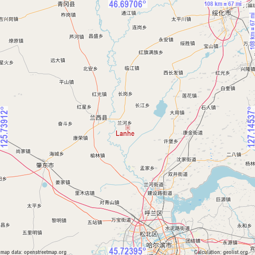
Lanhe GPS coordinates[2]
46° 12' 45.576" North, 126° 26' 32.064" East
| Map corner | latitude | longitude |
|---|---|---|
| Upper-left | 46.69706°, | 125.73912° |
| Center: | 46.21266°, | 126.44224° |
| Lower-right: | 45.72395°, | 127.14537° |
| Map W x H: | 108.2×108.2 km | = 67.2×67.2mi |
| max Lat: | 53.31946° ⇑4.6% North |
| Lanhe: | 46.21266° |
| min Lat: | ⇓95.4% South 18.22056° |
| min Long | Lanhe | max Long |
| 75.07348° | 126.44224° | 134.28917° |
| W 96%⇐ | ⇒4% E |
Elevation
Elevation of Lanhe is 125 m = 410 ft, and this is 359.8 m = 1180 ft below average elevation for this country.
| Max E: |
5622 m = 18445 ft | 55.9% |
| Avg. | 484.8 m = 1591 ft | |
| Lanhe | 125 m = 410 ft | |
Min E: |
-3 m = -10 ft | 44.1% |
See also: China elevation on elevation.city.
Geographical zone
Lanhe is located in North temperate zone (between Tropic of Cancer and the Arctic Circle). Distance of this North polar circle is 2262.8 km =1406 mi to North.| Distance of | km | miles | from Lanhe |
|---|---|---|---|
| North Pole | 4868.7 | 3025.3 | to North |
| Arctic Circle | 2262.8 | 1406 | to North |
| Tropic Cancer | 2532.4 | 1573.6 | to South |
| Equator | 5138.4 | 3192.9 | to South |


Nearby cities:
15 places around Lanhe: (largest is in red/bold)
• Changgang
14.8 km =9.2 mi,  357°
357°
• Changjiang
11.5 km =7.1 mi,  32°
32°
• Changling
23.9 km =14.9 mi,  140°
140°
• Dayong
22.4 km =13.9 mi,  69°
69°
• Hongguang
18.8 km =11.7 mi,  320°
320°
• Hongxing
20.4 km =12.7 mi,  296°
296°
• Hulan
28.3 km =17.6 mi,  154°
154°
• Kangjin
27.9 km =17.3 mi,  93°
93°
• Kangrong
14.9 km =9.3 mi,  262°
262°
• Lanxi
13.3 km =8.3 mi,  292°
292°
• Linjiang
25.5 km =15.8 mi,  4°
4°
• Mengjia
19 km =11.8 mi, 153°
• Shenjia
28.3 km =17.6 mi,  118°
118°
• Xubao
19 km =11.8 mi,  106°
106°
• Yulin
17 km =10.6 mi,  227°
227°
Sources, notices
• [Note1] Compared only with cities in China existing in our database
• [Src1] Map data: © OpenStreetMap contributors (CC-BY-SA)
• [Src2] Other city data from geonames.org with taken over terms of usage.
• [Src3] Geographical zone / Annual Mean Temperature by Robert A. Rohde @ Wikipedia
