Yinlianhu geodata
Yinlianhu (Hubei) is a seat of a fourth-order administrative division; located in China in Asia/Shanghai (GMT+8) time zone. In our database, there are 1268 cities with bigger population. Compared to other cities in China, 51.7% of cities are located further ↑North; 52.7% of cities are located further →East and 81.2% of cities have higher elevation than Yinlianhu. Note1


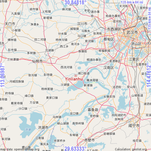
Yinlianhu GPS coordinates[2]
30° 14' 33.468" North, 113° 46' 22.764" East
| Map corner | latitude | longitude |
|---|---|---|
| Upper-left | 30.84818°, | 113.06987° |
| Center: | 30.24263°, | 113.77299° |
| Lower-right: | 29.63333°, | 114.47612° |
| Map W x H: | 135.1×135.1 km | = 83.9×83.9mi |
| max Lat: | 53.31946° ⇑51.7% North |
| Yinlianhu: | 30.24263° |
| min Lat: | ⇓48.3% South 18.22056° |
| min Long | Yinlianhu | max Long |
| 75.07348° | 113.77299° | 134.28917° |
| W 47.3%⇐ | ⇒52.7% E |
Elevation
Elevation of Yinlianhu is 24 m = 79 ft, and this is 460.8 m = 1512 ft below average elevation for this country.
| Max E: |
5622 m = 18445 ft | 81.2% |
| Avg. | 484.8 m = 1591 ft | |
| Yinlianhu | 24 m = 79 ft | |
Min E: |
-3 m = -10 ft | 18.8% |
See also: China elevation on elevation.city.
Geographical zone
Yinlianhu is located in North temperate zone (between Tropic of Cancer and the Arctic Circle). Distance of this Northern Tropic circle is 756.7 km =470.2 mi to South.| Distance of | km | miles | from Yinlianhu |
|---|---|---|---|
| North Pole | 6644.4 | 4128.6 | to North |
| Arctic Circle | 4038.5 | 2509.4 | to North |
| Tropic Cancer | 756.7 | 470.2 | to South |
| Equator | 3362.7 | 2089.5 | to South |


Nearby cities:
15 places around Yinlianhu: (largest is in red/bold)
• Chenggong
18.9 km =11.7 mi,  343°
343°
• Dengnan
20.7 km =12.9 mi,  71°
71°
• Dongchengyuan
17.5 km =10.9 mi,  48°
48°
• Hannan
7.2 km =4.5 mi, 69°
• Nanhe
27.8 km =17.3 mi,  0°
0°
• Paizhou
15.3 km =9.5 mi,  103°
103°
• Pengchang
25 km =15.5 mi,  272°
272°
• Shahu
12.3 km =7.6 mi,  230°
230°
• Xiaosi
8.3 km =5.2 mi,  359°
359°
• Xijiang
28.4 km =17.6 mi, 338°
• Xiliuhe
10.9 km =6.8 mi,  312°
312°
• Xintan
13.8 km =8.6 mi,  126°
126°
• Yanglinwei
27.9 km =17.3 mi,  244°
244°
• Yong’an
28.6 km =17.8 mi,  31°
31°
• Zhuru
22.9 km =14.2 mi,  15°
15°
Sources, notices
• [Note1] Compared only with cities in China existing in our database
• [Src1] Map data: © OpenStreetMap contributors (CC-BY-SA)
• [Src2] Other city data from geonames.org with taken over terms of usage.
• [Src3] Geographical zone / Annual Mean Temperature by Robert A. Rohde @ Wikipedia
