Xintan geodata
Xintan (Hubei) is a seat of a fourth-order administrative division; located in China in Asia/Shanghai (GMT+8) time zone. In our database, there are 1268 cities with bigger population. Compared to other cities in China, 52.4% of cities are located further ↑North; 52.1% of cities are located further →East and 78.3% of cities have higher elevation than Xintan. Note1


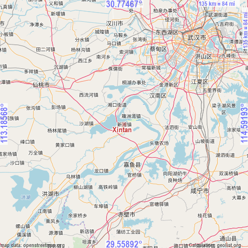
Xintan GPS coordinates[2]
30° 10' 7.212" North, 113° 53' 19.68" East
| Map corner | latitude | longitude |
|---|---|---|
| Upper-left | 30.77467°, | 113.18568° |
| Center: | 30.16867°, | 113.8888° |
| Lower-right: | 29.55892°, | 114.59193° |
| Map W x H: | 135.2×135.2 km | = 84×84mi |
| max Lat: | 53.31946° ⇑52.4% North |
| Xintan: | 30.16867° |
| min Lat: | ⇓47.6% South 18.22056° |
| min Long | Xintan | max Long |
| 75.07348° | 113.8888° | 134.28917° |
| W 47.9%⇐ | ⇒52.1% E |
Elevation
Elevation of Xintan is 30 m = 98 ft, and this is 454.8 m = 1492 ft below average elevation for this country.
| Max E: |
5622 m = 18445 ft | 78.3% |
| Avg. | 484.8 m = 1591 ft | |
| Xintan | 30 m = 98 ft | |
Min E: |
-3 m = -10 ft | 21.7% |
See also: China elevation on elevation.city.
Geographical zone
Xintan is located in North temperate zone (between Tropic of Cancer and the Arctic Circle). Distance of this Northern Tropic circle is 748.5 km =465.1 mi to South.| Distance of | km | miles | from Xintan |
|---|---|---|---|
| North Pole | 6652.6 | 4133.7 | to North |
| Arctic Circle | 4046.7 | 2514.5 | to North |
| Tropic Cancer | 748.5 | 465.1 | to South |
| Equator | 3354.4 | 2084.3 | to South |


Nearby cities:
15 places around Xintan: (largest is in red/bold)
• Dengnan
17.2 km =10.7 mi,  29°
29°
• Dongchengyuan
19.9 km =12.4 mi,  5°
5°
• Fasi
25.8 km =16 mi,  93°
93°
• Guanqiao
27.9 km =17.3 mi,  169°
169°
• Hannan
11.7 km =7.3 mi,  338°
338°
• Jinkou
30 km =18.6 mi,  50°
50°
• Longkou
28.2 km =17.5 mi,  206°
206°
• Niaojin
25.3 km =15.7 mi,  37°
37°
• Paizhou
5.9 km =3.7 mi, 39°
• Shahu
20.7 km =12.9 mi,  271°
271°
• Xiaosi
19.9 km =12.4 mi,  326°
326°
• Xiliuhe
24.7 km =15.3 mi,  309°
309°
• Xinjie
19.8 km =12.3 mi,  150°
150°
• Yinlianhu
13.8 km =8.6 mi, 306°
• Yuyue
18.2 km =11.3 mi,  156°
156°
Sources, notices
• [Note1] Compared only with cities in China existing in our database
• [Src1] Map data: © OpenStreetMap contributors (CC-BY-SA)
• [Src2] Other city data from geonames.org with taken over terms of usage.
• [Src3] Geographical zone / Annual Mean Temperature by Robert A. Rohde @ Wikipedia
