Hanji geodata
Hanji (Hubei) is a seat of a fourth-order administrative division; located in China in Asia/Shanghai (GMT+8) time zone. In our database, there are 1268 cities with bigger population. Compared to other cities in China, 51.9% of cities are located further ↓South; 53.7% of cities are located further →East and 79.8% of cities have higher elevation than Hanji. Note1


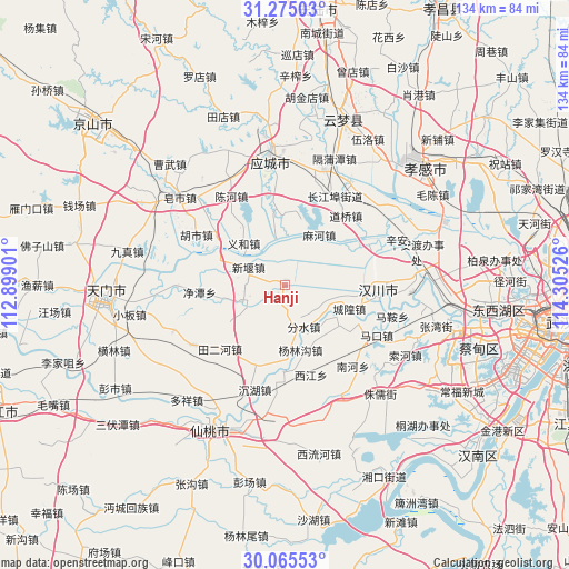
Hanji GPS coordinates[2]
30° 40' 19.812" North, 113° 36' 7.668" East
| Map corner | latitude | longitude |
|---|---|---|
| Upper-left | 31.27503°, | 112.89901° |
| Center: | 30.67217°, | 113.60213° |
| Lower-right: | 30.06553°, | 114.30526° |
| Map W x H: | 134.5×134.5 km | = 83.6×83.6mi |
| max Lat: | 53.31946° ⇑48.1% North |
| Hanji: | 30.67217° |
| min Lat: | ⇓51.9% South 18.22056° |
| min Long | Hanji | max Long |
| 75.07348° | 113.60213° | 134.28917° |
| W 46.3%⇐ | ⇒53.7% E |
Elevation
Elevation of Hanji is 27 m = 89 ft, and this is 457.8 m = 1502 ft below average elevation for this country.
| Max E: |
5622 m = 18445 ft | 79.8% |
| Avg. | 484.8 m = 1591 ft | |
| Hanji | 27 m = 89 ft | |
Min E: |
-3 m = -10 ft | 20.2% |
See also: China elevation on elevation.city.
Geographical zone
Hanji is located in North temperate zone (between Tropic of Cancer and the Arctic Circle). Distance of this Northern Tropic circle is 804.5 km =499.9 mi to South.| Distance of | km | miles | from Hanji |
|---|---|---|---|
| North Pole | 6596.6 | 4098.9 | to North |
| Arctic Circle | 3990.7 | 2479.7 | to North |
| Tropic Cancer | 804.5 | 499.9 | to South |
| Equator | 3410.4 | 2119.1 | to South |


Nearby cities:
15 places around Hanji: (largest is in red/bold)
• Chenghuang
16.2 km =10.1 mi,  110°
110°
• Dongzhong
19.9 km =12.4 mi,  304°
304°
• Fenshui
10.8 km =6.7 mi,  155°
155°
• Hanchuan
15.9 km =9.9 mi,  98°
98°
• Huilong
20.1 km =12.5 mi,  205°
205°
• Jingtan
20.3 km =12.6 mi,  264°
264°
• Litan
10.9 km =6.8 mi,  200°
200°
• Mahe
14.6 km =9.1 mi,  34°
34°
• Maiwang
19.4 km =12.1 mi,  181°
181°
• Miaotou
19.1 km =11.9 mi,  117°
117°
• Tian’e
11.5 km =7.1 mi,  349°
349°
• Wantan
12.5 km =7.8 mi,  144°
144°
• Xinyan
9.5 km =5.9 mi, 297°
• Yanglingou
15.8 km =9.8 mi,  166°
166°
• Yihe
13.1 km =8.1 mi,  315°
315°
Sources, notices
• [Note1] Compared only with cities in China existing in our database
• [Src1] Map data: © OpenStreetMap contributors (CC-BY-SA)
• [Src2] Other city data from geonames.org with taken over terms of usage.
• [Src3] Geographical zone / Annual Mean Temperature by Robert A. Rohde @ Wikipedia
