Donggong Cilao geodata
Donggong Cilao (Xinjiang) is a seat of a fourth-order administrative division; located in China in Asia/Urumqi (GMT+6) time zone. In our database, there are 1268 cities with bigger population. Compared to other cities in China, 89.6% of cities are located further ↓South; 69.4% of cities are located further →East and 93% of cities have lower elevation than Donggong Cilao. Note1


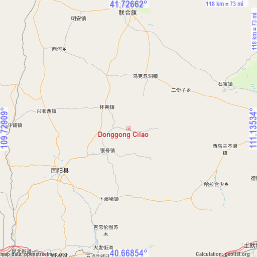
Donggong Cilao GPS coordinates[2]
41° 11' 58.992" North, 110° 25' 55.956" East
| Map corner | latitude | longitude |
|---|---|---|
| Upper-left | 41.72662°, | 109.72909° |
| Center: | 41.19972°, | 110.43221° |
| Lower-right: | 40.66854°, | 111.13534° |
| Map W x H: | 117.6×117.6 km | = 73.1×73.1mi |
| max Lat: | 53.31946° ⇑10.4% North |
| Donggong Cilao: | 41.19972° |
| min Lat: | ⇓89.6% South 18.22056° |
| min Long | Donggong Cilao | max Long |
| 75.07348° | 110.43221° | 134.28917° |
| W 30.6%⇐ | ⇒69.4% E |
Elevation
Elevation of Donggong Cilao is 1713 m = 5620 ft, and this is 1228.2 m = 4030 ft above average elevation for this country.
| Max E: |
5622 m = 18445 ft | 7% |
| Donggong Cilao | 1713 m 5620 ft | |
| Avg. | 484.8 m = 1591 ft | |
Min E: |
-3 m = -10 ft | 93% |
See also: China elevation on elevation.city.
Geographical zone
Donggong Cilao is located in North temperate zone (between Tropic of Cancer and the Arctic Circle). Distance of this Northern Tropic circle is 1975.1 km =1227.3 mi to South.| Distance of | km | miles | from Donggong Cilao |
|---|---|---|---|
| North Pole | 5426.1 | 3371.6 | to North |
| Arctic Circle | 2820.2 | 1752.4 | to North |
| Tropic Cancer | 1975.1 | 1227.3 | to South |
| Equator | 4581 | 2846.5 | to South |


Nearby cities:
15 places around Donggong Cilao: (largest is in red/bold)
• Bailingnao
20 km =12.4 mi,  299°
299°
• Butahai
14.4 km =8.9 mi,  316°
316°
• Damiao
13.4 km =8.3 mi,  152°
152°
• Donghongsheng
40.5 km =25.2 mi,  68°
68°
• Dongshengyong
32.3 km =20.1 mi,  237°
237°
• Erfenzi
30.7 km =19.1 mi,  53°
53°
• Gongyimin
39.9 km =24.8 mi,  234°
234°
• Halamendu
34 km =21.1 mi,  134°
134°
• Jihuluntu Sumu
47.3 km =29.4 mi,  192°
192°
• Jinshan
36.8 km =22.9 mi, 239°
• Xiashihao
36.5 km =22.7 mi,  156°
156°
• Xihong Shanzi
20.8 km =12.9 mi,  91°
91°
• Xinjiang
31.5 km =19.6 mi, 187°
• Xiwulan Bulang
45.8 km =28.5 mi,  101°
101°
• Yinhao
13.8 km =8.6 mi, 229°
Sources, notices
• [Note1] Compared only with cities in China existing in our database
• [Src1] Map data: © OpenStreetMap contributors (CC-BY-SA)
• [Src2] Other city data from geonames.org with taken over terms of usage.
• [Src3] Geographical zone / Annual Mean Temperature by Robert A. Rohde @ Wikipedia
